You are here: Home > Network List > US - United States National Seismic Network Stations List
> Station HAWA Hanford, Washington, USA > Earthquake Result Viewer
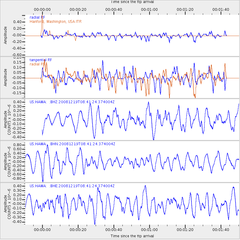
HAWA Hanford, Washington, USA - Earthquake Result Viewer
*The percent match for this event was below the threshold and hence no stack was calculated.
| Earthquake location: |
Northern Mid-Atlantic Ridge |
| Earthquake latitude/longitude: |
47.0/-27.3 |
| Earthquake time(UTC): |
2008/12/19 (354) 08:31:51 GMT |
| Earthquake Depth: |
2.0 km |
| Earthquake Magnitude: |
5.8 MB, 5.6 MS, 5.9 MW, 5.8 MW |
| Earthquake Catalog/Contributor: |
WHDF/NEIC |
|
| Network: |
US United States National Seismic Network |
| Station: |
HAWA Hanford, Washington, USA |
| Lat/Lon: |
46.39 N/119.53 W |
| Elevation: |
364 m |
|
| Distance: |
59.5 deg |
| Az: |
306.606 deg |
| Baz: |
52.543 deg |
| Ray Param: |
$rayparam |
*The percent match for this event was below the threshold and hence was not used in the summary stack. |
|
| Radial Match: |
54.539467 % |
| Radial Bump: |
400 |
| Transverse Match: |
51.301865 % |
| Transverse Bump: |
400 |
| SOD ConfigId: |
2658 |
| Insert Time: |
2010-03-05 05:16:05.193 +0000 |
| GWidth: |
2.5 |
| Max Bumps: |
400 |
| Tol: |
0.001 |
|
Signal To Noise
| Channel | StoN | STA | LTA |
| US:HAWA: :BHN:20081219T08:41:24.374004Z | 1.7942588 | 5.273976E-7 | 2.939362E-7 |
| US:HAWA: :BHE:20081219T08:41:24.374004Z | 0.5909089 | 7.7722255E-8 | 1.3153E-7 |
| US:HAWA: :BHZ:20081219T08:41:24.374004Z | 1.77072 | 2.2526466E-7 | 1.2721642E-7 |
| Arrivals |
| Ps | |
| PpPs | |
| PsPs/PpSs | |


