You are here: Home > Network List > US - United States National Seismic Network Stations List
> Station HAWA Hanford, Washington, USA > Earthquake Result Viewer
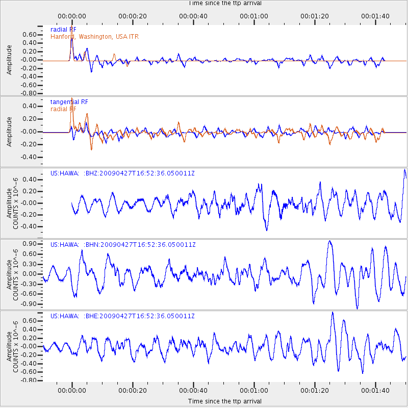
HAWA Hanford, Washington, USA - Earthquake Result Viewer
*The percent match for this event was below the threshold and hence no stack was calculated.
| Earthquake location: |
Guerrero, Mexico |
| Earthquake latitude/longitude: |
17.0/-99.4 |
| Earthquake time(UTC): |
2009/04/27 (117) 16:46:28 GMT |
| Earthquake Depth: |
35 km |
| Earthquake Magnitude: |
5.7 MB, 5.4 MS, 5.8 MW, 5.8 MW |
| Earthquake Catalog/Contributor: |
WHDF/NEIC |
|
| Network: |
US United States National Seismic Network |
| Station: |
HAWA Hanford, Washington, USA |
| Lat/Lon: |
46.39 N/119.53 W |
| Elevation: |
364 m |
|
| Distance: |
33.7 deg |
| Az: |
334.629 deg |
| Baz: |
143.683 deg |
| Ray Param: |
$rayparam |
*The percent match for this event was below the threshold and hence was not used in the summary stack. |
|
| Radial Match: |
66.911064 % |
| Radial Bump: |
400 |
| Transverse Match: |
64.71484 % |
| Transverse Bump: |
400 |
| SOD ConfigId: |
2658 |
| Insert Time: |
2010-03-05 05:16:07.709 +0000 |
| GWidth: |
2.5 |
| Max Bumps: |
400 |
| Tol: |
0.001 |
|
Signal To Noise
| Channel | StoN | STA | LTA |
| US:HAWA: :BHN:20090427T16:52:36.050011Z | 2.7838821 | 4.3563756E-7 | 1.5648563E-7 |
| US:HAWA: :BHE:20090427T16:52:36.050011Z | 2.005609 | 1.4209425E-7 | 7.084843E-8 |
| US:HAWA: :BHZ:20090427T16:52:36.050011Z | 1.1357698 | 1.0508848E-7 | 9.252621E-8 |
| Arrivals |
| Ps | |
| PpPs | |
| PsPs/PpSs | |


