You are here: Home > Network List > US - United States National Seismic Network Stations List
> Station HAWA Hanford, Washington, USA > Earthquake Result Viewer
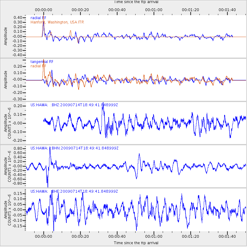
HAWA Hanford, Washington, USA - Earthquake Result Viewer
*The percent match for this event was below the threshold and hence no stack was calculated.
| Earthquake location: |
Chile-Bolivia Border Region |
| Earthquake latitude/longitude: |
-21.8/-67.1 |
| Earthquake time(UTC): |
2009/07/14 (195) 18:38:08 GMT |
| Earthquake Depth: |
176 km |
| Earthquake Magnitude: |
5.7 MW, 5.4 MB, 5.7 MW |
| Earthquake Catalog/Contributor: |
WHDF/NEIC |
|
| Network: |
US United States National Seismic Network |
| Station: |
HAWA Hanford, Washington, USA |
| Lat/Lon: |
46.39 N/119.53 W |
| Elevation: |
364 m |
|
| Distance: |
82.8 deg |
| Az: |
326.422 deg |
| Baz: |
132.056 deg |
| Ray Param: |
$rayparam |
*The percent match for this event was below the threshold and hence was not used in the summary stack. |
|
| Radial Match: |
71.64724 % |
| Radial Bump: |
400 |
| Transverse Match: |
65.46968 % |
| Transverse Bump: |
396 |
| SOD ConfigId: |
2648 |
| Insert Time: |
2010-03-05 05:16:10.174 +0000 |
| GWidth: |
2.5 |
| Max Bumps: |
400 |
| Tol: |
0.001 |
|
Signal To Noise
| Channel | StoN | STA | LTA |
| US:HAWA: :BHN:20090714T18:49:41.848999Z | 6.094206 | 3.8344652E-7 | 6.291985E-8 |
| US:HAWA: :BHE:20090714T18:49:41.848999Z | 1.479077 | 7.690335E-8 | 5.1994146E-8 |
| US:HAWA: :BHZ:20090714T18:49:41.848999Z | 2.414432 | 1.1033473E-7 | 4.5698005E-8 |
| Arrivals |
| Ps | |
| PpPs | |
| PsPs/PpSs | |


