You are here: Home > Network List > US - United States National Seismic Network Stations List
> Station HAWA Hanford, Washington, USA > Earthquake Result Viewer
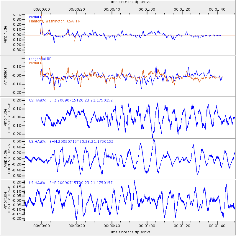
HAWA Hanford, Washington, USA - Earthquake Result Viewer
*The percent match for this event was below the threshold and hence no stack was calculated.
| Earthquake location: |
New Ireland Region, P.N.G. |
| Earthquake latitude/longitude: |
-3.4/150.5 |
| Earthquake time(UTC): |
2009/07/15 (196) 20:10:42 GMT |
| Earthquake Depth: |
13 km |
| Earthquake Magnitude: |
5.6 MB, 6.1 MS, 6.1 MW, 6.1 MW |
| Earthquake Catalog/Contributor: |
WHDF/NEIC |
|
| Network: |
US United States National Seismic Network |
| Station: |
HAWA Hanford, Washington, USA |
| Lat/Lon: |
46.39 N/119.53 W |
| Elevation: |
364 m |
|
| Distance: |
92.4 deg |
| Az: |
43.848 deg |
| Baz: |
267.65 deg |
| Ray Param: |
$rayparam |
*The percent match for this event was below the threshold and hence was not used in the summary stack. |
|
| Radial Match: |
64.61717 % |
| Radial Bump: |
400 |
| Transverse Match: |
44.482334 % |
| Transverse Bump: |
400 |
| SOD ConfigId: |
2648 |
| Insert Time: |
2010-03-05 05:16:10.833 +0000 |
| GWidth: |
2.5 |
| Max Bumps: |
400 |
| Tol: |
0.001 |
|
Signal To Noise
| Channel | StoN | STA | LTA |
| US:HAWA: :BHN:20090715T20:23:21.175015Z | 0.93237865 | 6.58589E-8 | 7.063535E-8 |
| US:HAWA: :BHE:20090715T20:23:21.175015Z | 1.996407 | 1.0296721E-7 | 5.1576265E-8 |
| US:HAWA: :BHZ:20090715T20:23:21.175015Z | 0.5737847 | 3.3998422E-8 | 5.9252926E-8 |
| Arrivals |
| Ps | |
| PpPs | |
| PsPs/PpSs | |


