You are here: Home > Network List > US - United States National Seismic Network Stations List
> Station HAWA Hanford, Washington, USA > Earthquake Result Viewer
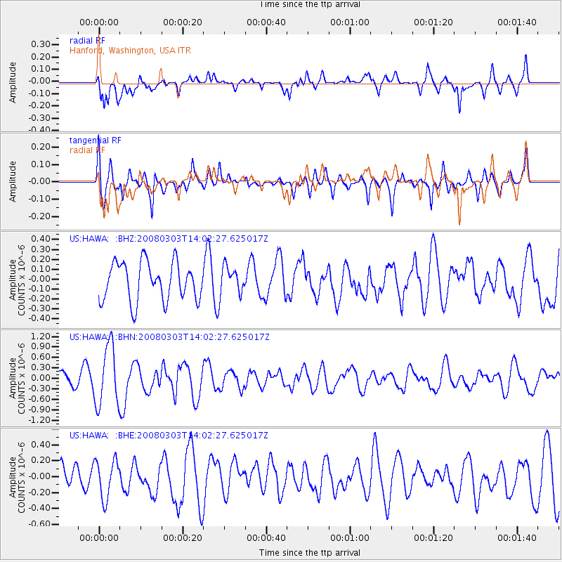
HAWA Hanford, Washington, USA - Earthquake Result Viewer
*The percent match for this event was below the threshold and hence no stack was calculated.
| Earthquake location: |
Philippine Islands Region |
| Earthquake latitude/longitude: |
19.9/121.3 |
| Earthquake time(UTC): |
2008/03/03 (063) 13:49:40 GMT |
| Earthquake Depth: |
10 km |
| Earthquake Magnitude: |
6.0 MB, 6.0 MW, 5.9 MW |
| Earthquake Catalog/Contributor: |
WHDF/NEIC |
|
| Network: |
US United States National Seismic Network |
| Station: |
HAWA Hanford, Washington, USA |
| Lat/Lon: |
46.39 N/119.53 W |
| Elevation: |
364 m |
|
| Distance: |
94.2 deg |
| Az: |
37.314 deg |
| Baz: |
304.505 deg |
| Ray Param: |
$rayparam |
*The percent match for this event was below the threshold and hence was not used in the summary stack. |
|
| Radial Match: |
69.156906 % |
| Radial Bump: |
400 |
| Transverse Match: |
65.52721 % |
| Transverse Bump: |
400 |
| SOD ConfigId: |
2504 |
| Insert Time: |
2010-03-05 05:16:12.154 +0000 |
| GWidth: |
2.5 |
| Max Bumps: |
400 |
| Tol: |
0.001 |
|
Signal To Noise
| Channel | StoN | STA | LTA |
| US:HAWA: :BHN:20080303T14:02:27.625017Z | 2.7197468 | 8.7660123E-7 | 3.2230986E-7 |
| US:HAWA: :BHE:20080303T14:02:27.625017Z | 1.5125395 | 2.4394564E-7 | 1.6128217E-7 |
| US:HAWA: :BHZ:20080303T14:02:27.625017Z | 0.6503694 | 1.2524438E-7 | 1.9257423E-7 |
| Arrivals |
| Ps | |
| PpPs | |
| PsPs/PpSs | |


