You are here: Home > Network List > US - United States National Seismic Network Stations List
> Station HAWA Hanford, Washington, USA > Earthquake Result Viewer
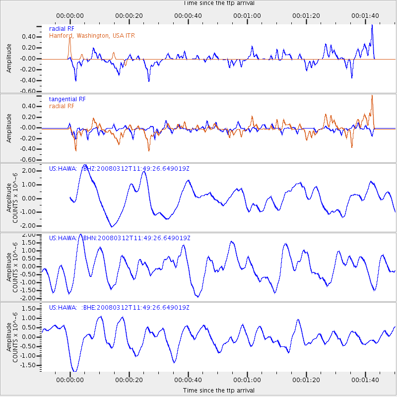
HAWA Hanford, Washington, USA - Earthquake Result Viewer
*The percent match for this event was below the threshold and hence no stack was calculated.
| Earthquake location: |
Vanuatu Islands |
| Earthquake latitude/longitude: |
-16.5/167.2 |
| Earthquake time(UTC): |
2008/03/12 (072) 11:36:55 GMT |
| Earthquake Depth: |
10 km |
| Earthquake Magnitude: |
5.6 MB, 6.3 MW |
| Earthquake Catalog/Contributor: |
WHDF/NEIC |
|
| Network: |
US United States National Seismic Network |
| Station: |
HAWA Hanford, Washington, USA |
| Lat/Lon: |
46.39 N/119.53 W |
| Elevation: |
364 m |
|
| Distance: |
90.7 deg |
| Az: |
41.525 deg |
| Baz: |
246.769 deg |
| Ray Param: |
$rayparam |
*The percent match for this event was below the threshold and hence was not used in the summary stack. |
|
| Radial Match: |
48.442554 % |
| Radial Bump: |
382 |
| Transverse Match: |
59.961468 % |
| Transverse Bump: |
386 |
| SOD ConfigId: |
2504 |
| Insert Time: |
2010-03-05 05:16:14.115 +0000 |
| GWidth: |
2.5 |
| Max Bumps: |
400 |
| Tol: |
0.001 |
|
Signal To Noise
| Channel | StoN | STA | LTA |
| US:HAWA: :BHN:20080312T11:49:26.649019Z | 1.8038661 | 1.4558623E-6 | 8.070789E-7 |
| US:HAWA: :BHE:20080312T11:49:26.649019Z | 1.9398519 | 1.2714537E-6 | 6.5543855E-7 |
| US:HAWA: :BHZ:20080312T11:49:26.649019Z | 1.1327295 | 1.4705568E-6 | 1.2982417E-6 |
| Arrivals |
| Ps | |
| PpPs | |
| PsPs/PpSs | |


