You are here: Home > Network List > US - United States National Seismic Network Stations List
> Station HAWA Hanford, Washington, USA > Earthquake Result Viewer
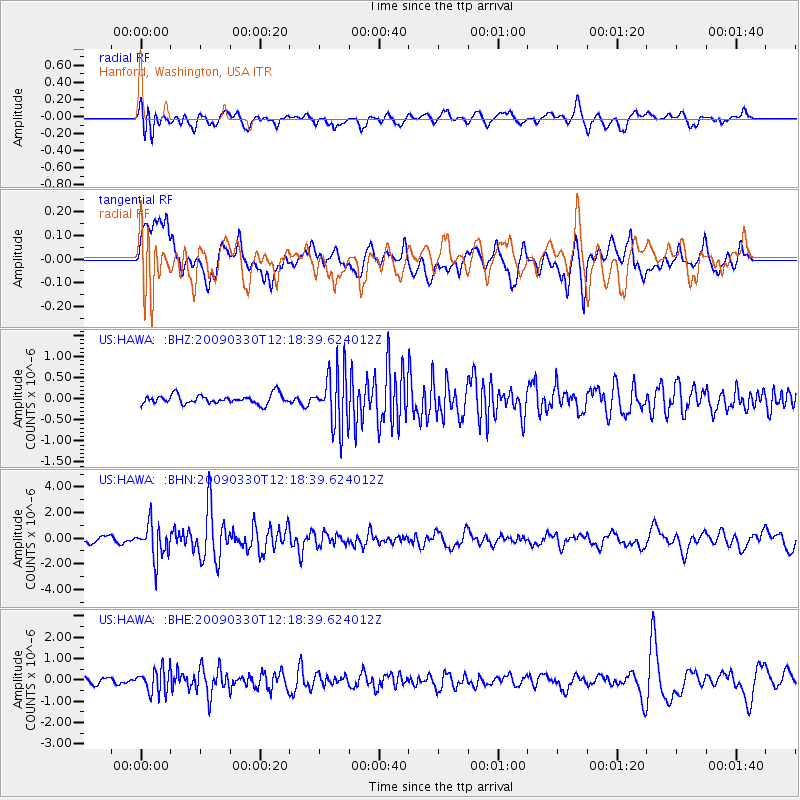
HAWA Hanford, Washington, USA - Earthquake Result Viewer
*The percent match for this event was below the threshold and hence no stack was calculated.
| Earthquake location: |
Andreanof Islands, Aleutian Is. |
| Earthquake latitude/longitude: |
51.5/-178.3 |
| Earthquake time(UTC): |
2009/03/30 (089) 12:11:54 GMT |
| Earthquake Depth: |
31 km |
| Earthquake Magnitude: |
6.0 MB, 5.8 MW, 5.7 MW |
| Earthquake Catalog/Contributor: |
WHDF/NEIC |
|
| Network: |
US United States National Seismic Network |
| Station: |
HAWA Hanford, Washington, USA |
| Lat/Lon: |
46.39 N/119.53 W |
| Elevation: |
364 m |
|
| Distance: |
38.0 deg |
| Az: |
73.932 deg |
| Baz: |
299.85 deg |
| Ray Param: |
$rayparam |
*The percent match for this event was below the threshold and hence was not used in the summary stack. |
|
| Radial Match: |
62.554157 % |
| Radial Bump: |
400 |
| Transverse Match: |
58.87224 % |
| Transverse Bump: |
400 |
| SOD ConfigId: |
2658 |
| Insert Time: |
2010-03-05 05:16:17.271 +0000 |
| GWidth: |
2.5 |
| Max Bumps: |
400 |
| Tol: |
0.001 |
|
Signal To Noise
| Channel | StoN | STA | LTA |
| US:HAWA: :BHN:20090330T12:18:39.624012Z | 5.665494 | 1.3395804E-6 | 2.3644549E-7 |
| US:HAWA: :BHE:20090330T12:18:39.624012Z | 3.9982176 | 5.608547E-7 | 1.4027619E-7 |
| US:HAWA: :BHZ:20090330T12:18:39.624012Z | 6.123922 | 6.706107E-7 | 1.09506736E-7 |
| Arrivals |
| Ps | |
| PpPs | |
| PsPs/PpSs | |


