You are here: Home > Network List > US - United States National Seismic Network Stations List
> Station HAWA Hanford, Washington, USA > Earthquake Result Viewer
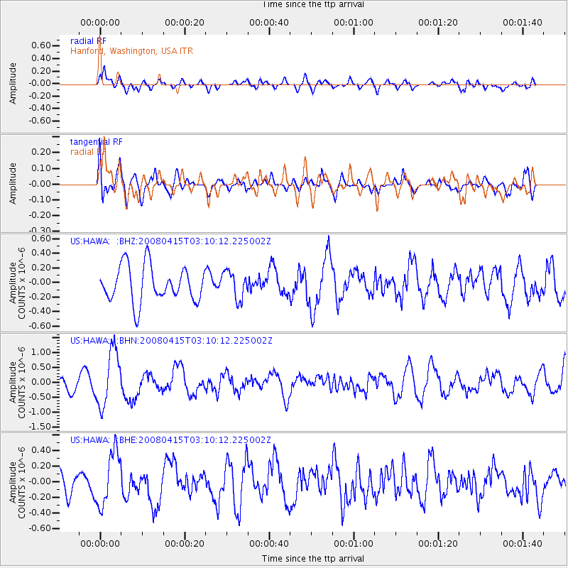
HAWA Hanford, Washington, USA - Earthquake Result Viewer
*The percent match for this event was below the threshold and hence no stack was calculated.
| Earthquake location: |
Near Coast Of Guatemala |
| Earthquake latitude/longitude: |
13.6/-90.6 |
| Earthquake time(UTC): |
2008/04/15 (106) 03:03:04 GMT |
| Earthquake Depth: |
33 km |
| Earthquake Magnitude: |
5.6 MB, 5.8 MS, 6.1 MW, 6.1 MW |
| Earthquake Catalog/Contributor: |
WHDF/NEIC |
|
| Network: |
US United States National Seismic Network |
| Station: |
HAWA Hanford, Washington, USA |
| Lat/Lon: |
46.39 N/119.53 W |
| Elevation: |
364 m |
|
| Distance: |
40.8 deg |
| Az: |
329.155 deg |
| Baz: |
133.915 deg |
| Ray Param: |
$rayparam |
*The percent match for this event was below the threshold and hence was not used in the summary stack. |
|
| Radial Match: |
52.942593 % |
| Radial Bump: |
400 |
| Transverse Match: |
47.215286 % |
| Transverse Bump: |
400 |
| SOD ConfigId: |
2504 |
| Insert Time: |
2010-03-05 05:16:19.315 +0000 |
| GWidth: |
2.5 |
| Max Bumps: |
400 |
| Tol: |
0.001 |
|
Signal To Noise
| Channel | StoN | STA | LTA |
| US:HAWA: :BHN:20080415T03:10:12.225002Z | 3.4307432 | 9.4527775E-7 | 2.7553148E-7 |
| US:HAWA: :BHE:20080415T03:10:12.225002Z | 1.9634033 | 3.519646E-7 | 1.7926249E-7 |
| US:HAWA: :BHZ:20080415T03:10:12.225002Z | 0.79077166 | 1.9373866E-7 | 2.4499948E-7 |
| Arrivals |
| Ps | |
| PpPs | |
| PsPs/PpSs | |


