You are here: Home > Network List > US - United States National Seismic Network Stations List
> Station HAWA Hanford, Washington, USA > Earthquake Result Viewer
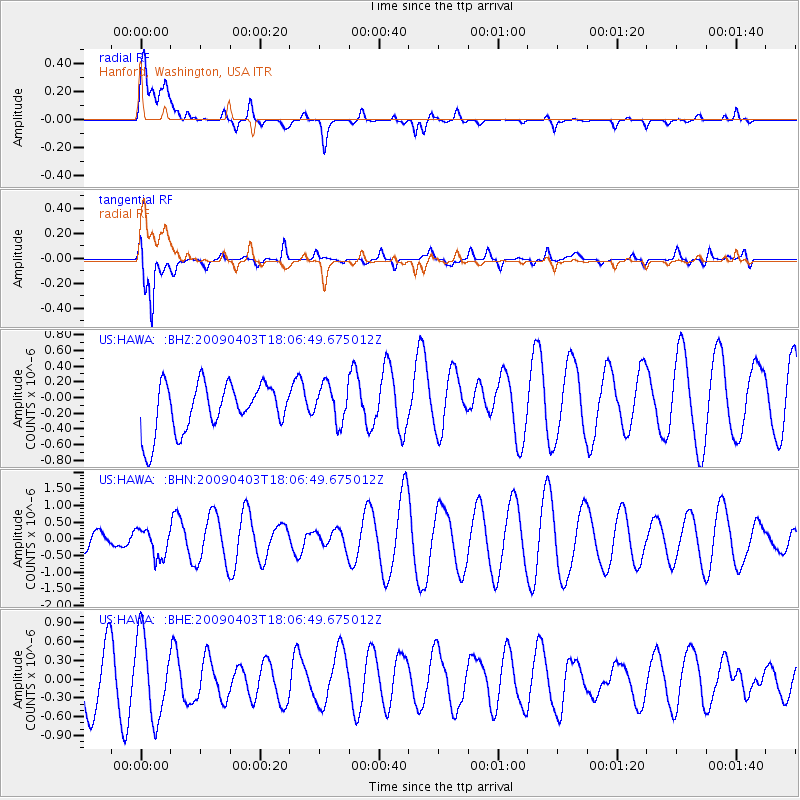
HAWA Hanford, Washington, USA - Earthquake Result Viewer
*The percent match for this event was below the threshold and hence no stack was calculated.
| Earthquake location: |
Catamarca Province, Argentina |
| Earthquake latitude/longitude: |
-27.8/-66.6 |
| Earthquake time(UTC): |
2009/04/03 (093) 17:54:50 GMT |
| Earthquake Depth: |
174 km |
| Earthquake Magnitude: |
5.7 MW, 5.3 MB, 5.7 MW |
| Earthquake Catalog/Contributor: |
WHDF/NEIC |
|
| Network: |
US United States National Seismic Network |
| Station: |
HAWA Hanford, Washington, USA |
| Lat/Lon: |
46.39 N/119.53 W |
| Elevation: |
364 m |
|
| Distance: |
88.0 deg |
| Az: |
326.451 deg |
| Baz: |
135.004 deg |
| Ray Param: |
$rayparam |
*The percent match for this event was below the threshold and hence was not used in the summary stack. |
|
| Radial Match: |
49.058716 % |
| Radial Bump: |
400 |
| Transverse Match: |
75.40043 % |
| Transverse Bump: |
400 |
| SOD ConfigId: |
2658 |
| Insert Time: |
2010-03-05 05:16:20.565 +0000 |
| GWidth: |
2.5 |
| Max Bumps: |
400 |
| Tol: |
0.001 |
|
Signal To Noise
| Channel | StoN | STA | LTA |
| US:HAWA: :BHN:20090403T18:06:49.675012Z | 0.6088936 | 4.3004295E-7 | 7.062695E-7 |
| US:HAWA: :BHE:20090403T18:06:49.675012Z | 1.2559004 | 6.5059936E-7 | 5.180342E-7 |
| US:HAWA: :BHZ:20090403T18:06:49.675012Z | 0.77868277 | 2.4046003E-7 | 3.0880358E-7 |
| Arrivals |
| Ps | |
| PpPs | |
| PsPs/PpSs | |


