You are here: Home > Network List > US - United States National Seismic Network Stations List
> Station HAWA Hanford, Washington, USA > Earthquake Result Viewer
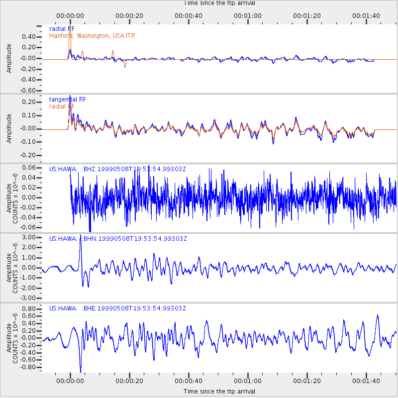
HAWA Hanford, Washington, USA - Earthquake Result Viewer
*The percent match for this event was below the threshold and hence no stack was calculated.
| Earthquake location: |
Kuril Islands |
| Earthquake latitude/longitude: |
45.4/151.6 |
| Earthquake time(UTC): |
1999/05/08 (128) 19:44:35 GMT |
| Earthquake Depth: |
63 km |
| Earthquake Magnitude: |
6.2 MB, 5.3 MS, 5.9 MW, 5.9 MW |
| Earthquake Catalog/Contributor: |
WHDF/NEIC |
|
| Network: |
US United States National Seismic Network |
| Station: |
HAWA Hanford, Washington, USA |
| Lat/Lon: |
46.39 N/119.53 W |
| Elevation: |
364 m |
|
| Distance: |
58.5 deg |
| Az: |
54.254 deg |
| Baz: |
304.367 deg |
| Ray Param: |
$rayparam |
*The percent match for this event was below the threshold and hence was not used in the summary stack. |
|
| Radial Match: |
56.614635 % |
| Radial Bump: |
400 |
| Transverse Match: |
56.062603 % |
| Transverse Bump: |
400 |
| SOD ConfigId: |
4480 |
| Insert Time: |
2010-03-05 05:16:21.182 +0000 |
| GWidth: |
2.5 |
| Max Bumps: |
400 |
| Tol: |
0.001 |
|
Signal To Noise
| Channel | StoN | STA | LTA |
| US:HAWA: :BHN:19990508T19:53:54.99303Z | 6.069391 | 1.0563076E-6 | 1.7403848E-7 |
| US:HAWA: :BHE:19990508T19:53:54.99303Z | 1.5228015 | 3.2034959E-7 | 2.1036857E-7 |
| US:HAWA: :BHZ:19990508T19:53:54.99303Z | 0.8732837 | 1.8725313E-8 | 2.1442418E-8 |
| Arrivals |
| Ps | |
| PpPs | |
| PsPs/PpSs | |


