You are here: Home > Network List > US - United States National Seismic Network Stations List
> Station HAWA Hanford, Washington, USA > Earthquake Result Viewer
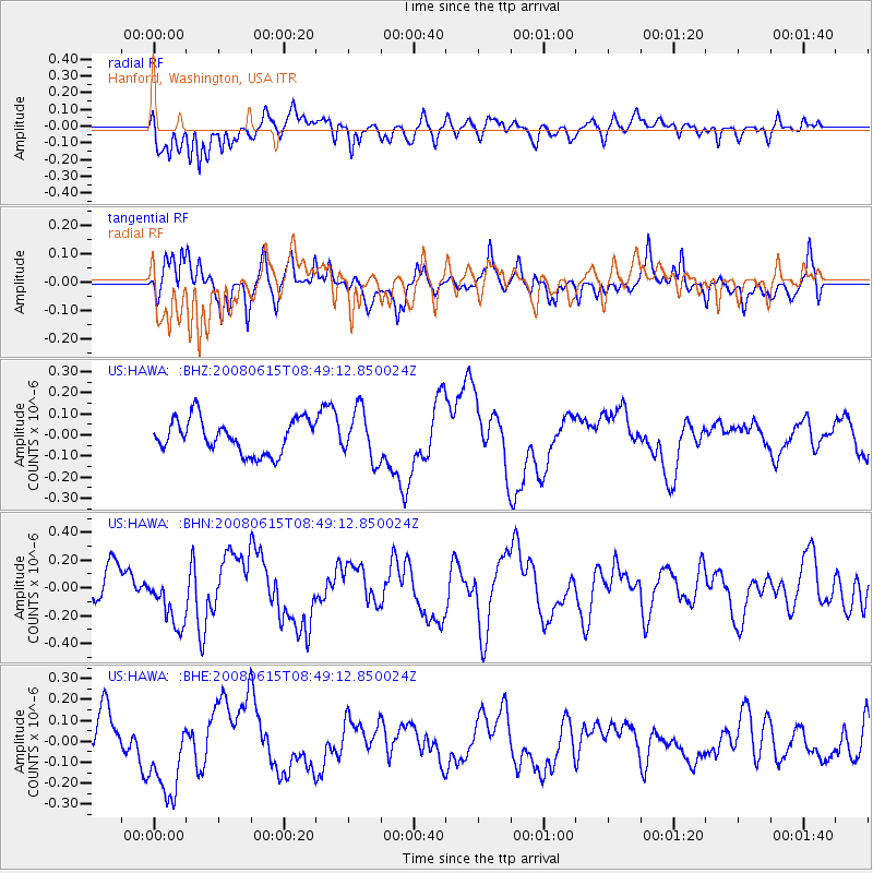
HAWA Hanford, Washington, USA - Earthquake Result Viewer
*The percent match for this event was below the threshold and hence no stack was calculated.
| Earthquake location: |
Southern East Pacific Rise |
| Earthquake latitude/longitude: |
-36.6/-107.4 |
| Earthquake time(UTC): |
2008/06/15 (167) 08:37:17 GMT |
| Earthquake Depth: |
10 km |
| Earthquake Magnitude: |
5.5 MB, 5.4 MS, 6.0 MW, 6.0 MW |
| Earthquake Catalog/Contributor: |
WHDF/NEIC |
|
| Network: |
US United States National Seismic Network |
| Station: |
HAWA Hanford, Washington, USA |
| Lat/Lon: |
46.39 N/119.53 W |
| Elevation: |
364 m |
|
| Distance: |
83.4 deg |
| Az: |
351.613 deg |
| Baz: |
170.239 deg |
| Ray Param: |
$rayparam |
*The percent match for this event was below the threshold and hence was not used in the summary stack. |
|
| Radial Match: |
71.414764 % |
| Radial Bump: |
400 |
| Transverse Match: |
80.33599 % |
| Transverse Bump: |
400 |
| SOD ConfigId: |
2504 |
| Insert Time: |
2010-03-05 05:16:25.912 +0000 |
| GWidth: |
2.5 |
| Max Bumps: |
400 |
| Tol: |
0.001 |
|
Signal To Noise
| Channel | StoN | STA | LTA |
| US:HAWA: :BHN:20080615T08:49:12.850024Z | 1.470122 | 1.994717E-7 | 1.3568378E-7 |
| US:HAWA: :BHE:20080615T08:49:12.850024Z | 2.0445244 | 2.0668435E-7 | 1.0109165E-7 |
| US:HAWA: :BHZ:20080615T08:49:12.850024Z | 1.4655302 | 1.176762E-7 | 8.0296E-8 |
| Arrivals |
| Ps | |
| PpPs | |
| PsPs/PpSs | |


