You are here: Home > Network List > US - United States National Seismic Network Stations List
> Station HAWA Hanford, Washington, USA > Earthquake Result Viewer
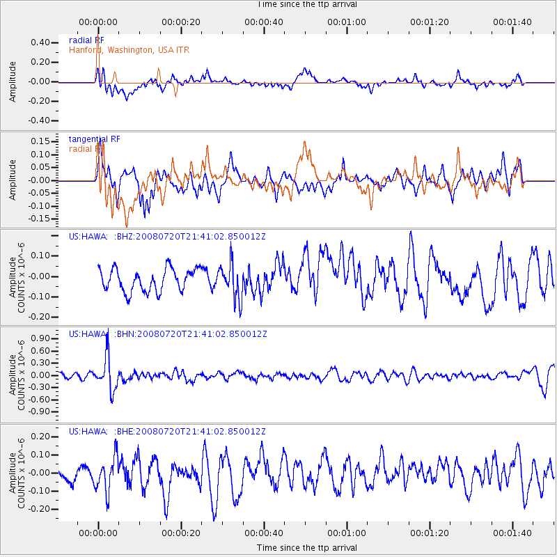
HAWA Hanford, Washington, USA - Earthquake Result Viewer
*The percent match for this event was below the threshold and hence no stack was calculated.
| Earthquake location: |
Bonin Islands, Japan Region |
| Earthquake latitude/longitude: |
27.8/139.6 |
| Earthquake time(UTC): |
2008/07/20 (202) 21:30:29 GMT |
| Earthquake Depth: |
481 km |
| Earthquake Magnitude: |
5.8 MW, 5.1 MB, 5.8 MW |
| Earthquake Catalog/Contributor: |
WHDF/NEIC |
|
| Network: |
US United States National Seismic Network |
| Station: |
HAWA Hanford, Washington, USA |
| Lat/Lon: |
46.39 N/119.53 W |
| Elevation: |
364 m |
|
| Distance: |
77.3 deg |
| Az: |
44.162 deg |
| Baz: |
296.886 deg |
| Ray Param: |
$rayparam |
*The percent match for this event was below the threshold and hence was not used in the summary stack. |
|
| Radial Match: |
38.701843 % |
| Radial Bump: |
400 |
| Transverse Match: |
42.491203 % |
| Transverse Bump: |
365 |
| SOD ConfigId: |
2504 |
| Insert Time: |
2010-03-05 05:16:26.562 +0000 |
| GWidth: |
2.5 |
| Max Bumps: |
400 |
| Tol: |
0.001 |
|
Signal To Noise
| Channel | StoN | STA | LTA |
| US:HAWA: :BHN:20080720T21:41:02.850012Z | 5.1081514 | 4.151172E-7 | 8.126564E-8 |
| US:HAWA: :BHE:20080720T21:41:02.850012Z | 2.0749981 | 9.7374645E-8 | 4.6927582E-8 |
| US:HAWA: :BHZ:20080720T21:41:02.850012Z | 1.6038681 | 8.821124E-8 | 5.4999056E-8 |
| Arrivals |
| Ps | |
| PpPs | |
| PsPs/PpSs | |


