You are here: Home > Network List > US - United States National Seismic Network Stations List
> Station HAWA Hanford, Washington, USA > Earthquake Result Viewer
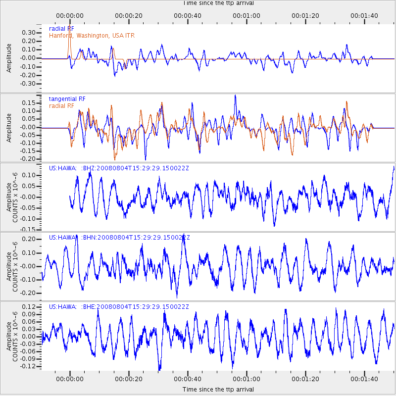
HAWA Hanford, Washington, USA - Earthquake Result Viewer
*The percent match for this event was below the threshold and hence no stack was calculated.
| Earthquake location: |
New Britain Region, P.N.G. |
| Earthquake latitude/longitude: |
-5.1/151.8 |
| Earthquake time(UTC): |
2008/08/04 (217) 15:16:53 GMT |
| Earthquake Depth: |
45 km |
| Earthquake Magnitude: |
5.5 MW, 4.8 MS, 5.2 MB |
| Earthquake Catalog/Contributor: |
WHDF/NEIC |
|
| Network: |
US United States National Seismic Network |
| Station: |
HAWA Hanford, Washington, USA |
| Lat/Lon: |
46.39 N/119.53 W |
| Elevation: |
364 m |
|
| Distance: |
92.7 deg |
| Az: |
43.846 deg |
| Baz: |
265.561 deg |
| Ray Param: |
$rayparam |
*The percent match for this event was below the threshold and hence was not used in the summary stack. |
|
| Radial Match: |
55.976067 % |
| Radial Bump: |
400 |
| Transverse Match: |
51.15998 % |
| Transverse Bump: |
400 |
| SOD ConfigId: |
2504 |
| Insert Time: |
2010-03-05 05:16:30.107 +0000 |
| GWidth: |
2.5 |
| Max Bumps: |
400 |
| Tol: |
0.001 |
|
Signal To Noise
| Channel | StoN | STA | LTA |
| US:HAWA: :BHN:20080804T15:29:29.150022Z | 2.0580723 | 1.2113037E-7 | 5.885623E-8 |
| US:HAWA: :BHE:20080804T15:29:29.150022Z | 0.54354846 | 2.466449E-8 | 4.5376797E-8 |
| US:HAWA: :BHZ:20080804T15:29:29.150022Z | 0.73312277 | 3.869305E-8 | 5.2778404E-8 |
| Arrivals |
| Ps | |
| PpPs | |
| PsPs/PpSs | |


