You are here: Home > Network List > US - United States National Seismic Network Stations List
> Station HAWA Hanford, Washington, USA > Earthquake Result Viewer
HAWA Hanford, Washington, USA - Earthquake Result Viewer
*The percent match for this event was below the threshold and hence no stack was calculated.
| Earthquake location: |
Tajikistan-Xinjiang Border Reg. |
| Earthquake latitude/longitude: |
39.5/73.9 |
| Earthquake time(UTC): |
2008/10/05 (279) 16:11:10 GMT |
| Earthquake Depth: |
35 km |
| Earthquake Magnitude: |
5.6 MB |
| Earthquake Catalog/Contributor: |
WHDF/NEIC |
|
| Network: |
US United States National Seismic Network |
| Station: |
HAWA Hanford, Washington, USA |
| Lat/Lon: |
46.39 N/119.53 W |
| Elevation: |
364 m |
|
| Distance: |
93.6 deg |
| Az: |
9.263 deg |
| Baz: |
349.635 deg |
| Ray Param: |
$rayparam |
*The percent match for this event was below the threshold and hence was not used in the summary stack. |
|
| Radial Match: |
52.249493 % |
| Radial Bump: |
377 |
| Transverse Match: |
51.076233 % |
| Transverse Bump: |
400 |
| SOD ConfigId: |
2556 |
| Insert Time: |
2010-03-05 05:16:31.108 +0000 |
| GWidth: |
2.5 |
| Max Bumps: |
400 |
| Tol: |
0.001 |
|
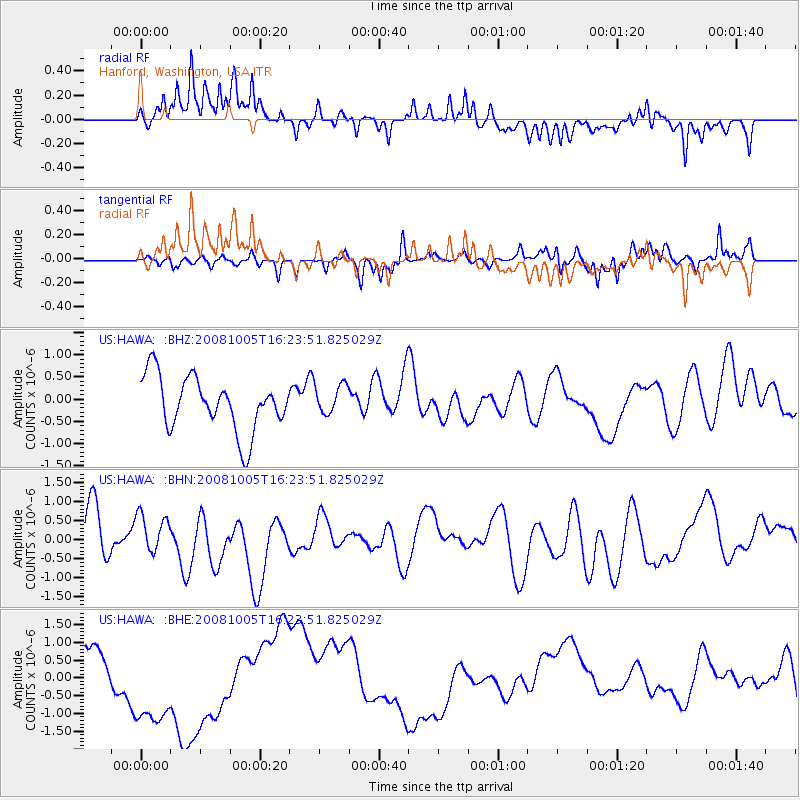
Signal To Noise
| Channel | StoN | STA | LTA |
| US:HAWA: :BHN:20081005T16:23:51.825029Z | 0.82392454 | 5.138228E-7 | 6.2362847E-7 |
| US:HAWA: :BHE:20081005T16:23:51.825029Z | 2.0652983 | 1.5045817E-6 | 7.285058E-7 |
| US:HAWA: :BHZ:20081005T16:23:51.825029Z | 0.5594433 | 3.3877413E-7 | 6.055558E-7 |
| Arrivals |
| Ps | |
| PpPs | |
| PsPs/PpSs | |


