You are here: Home > Network List > US - United States National Seismic Network Stations List
> Station HAWA Hanford, Washington, USA > Earthquake Result Viewer
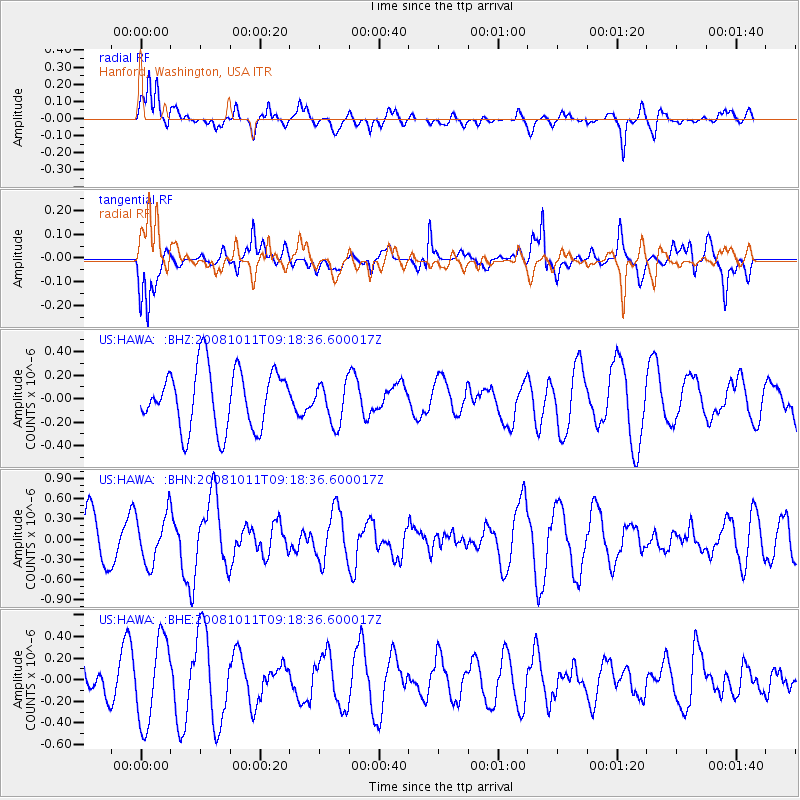
HAWA Hanford, Washington, USA - Earthquake Result Viewer
*The percent match for this event was below the threshold and hence no stack was calculated.
| Earthquake location: |
Eastern Caucasus |
| Earthquake latitude/longitude: |
43.4/46.3 |
| Earthquake time(UTC): |
2008/10/11 (285) 09:06:10 GMT |
| Earthquake Depth: |
16 km |
| Earthquake Magnitude: |
5.6 MB, 5.5 MS, 5.8 MW, 5.7 MW |
| Earthquake Catalog/Contributor: |
WHDF/NEIC |
|
| Network: |
US United States National Seismic Network |
| Station: |
HAWA Hanford, Washington, USA |
| Lat/Lon: |
46.39 N/119.53 W |
| Elevation: |
364 m |
|
| Distance: |
89.7 deg |
| Az: |
350.215 deg |
| Baz: |
10.314 deg |
| Ray Param: |
$rayparam |
*The percent match for this event was below the threshold and hence was not used in the summary stack. |
|
| Radial Match: |
63.629692 % |
| Radial Bump: |
400 |
| Transverse Match: |
65.16343 % |
| Transverse Bump: |
400 |
| SOD ConfigId: |
2556 |
| Insert Time: |
2010-03-05 05:16:33.003 +0000 |
| GWidth: |
2.5 |
| Max Bumps: |
400 |
| Tol: |
0.001 |
|
Signal To Noise
| Channel | StoN | STA | LTA |
| US:HAWA: :BHN:20081011T09:18:36.600017Z | 1.0593405 | 3.5770006E-7 | 3.3766298E-7 |
| US:HAWA: :BHE:20081011T09:18:36.600017Z | 2.2076094 | 3.8911628E-7 | 1.7626138E-7 |
| US:HAWA: :BHZ:20081011T09:18:36.600017Z | 0.6896728 | 1.7459398E-7 | 2.5315478E-7 |
| Arrivals |
| Ps | |
| PpPs | |
| PsPs/PpSs | |


