You are here: Home > Network List > US - United States National Seismic Network Stations List
> Station AMTX Amarillo, Texas, USA > Earthquake Result Viewer
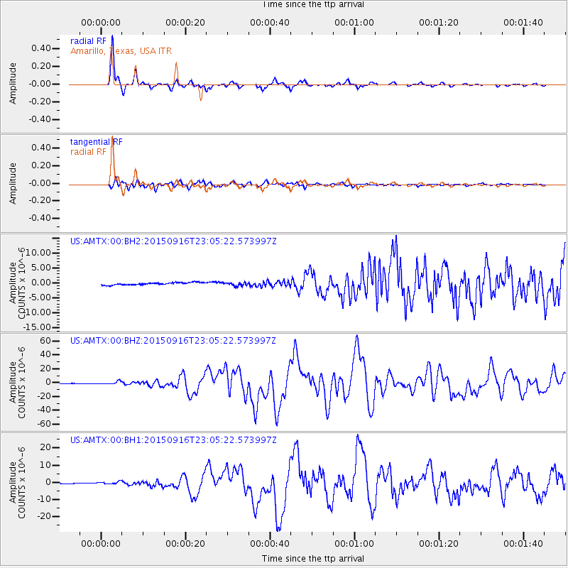
AMTX Amarillo, Texas, USA - Earthquake Result Viewer
*The percent match for this event was below the threshold and hence no stack was calculated.
| Earthquake location: |
Near Coast Of Central Chile |
| Earthquake latitude/longitude: |
-31.6/-71.8 |
| Earthquake time(UTC): |
2015/09/16 (259) 22:54:31 GMT |
| Earthquake Depth: |
12 km |
| Earthquake Magnitude: |
8.3 MWW, 7.9 MI |
| Earthquake Catalog/Contributor: |
NEIC PDE/NEIC COMCAT |
|
| Network: |
US United States National Seismic Network |
| Station: |
AMTX Amarillo, Texas, USA |
| Lat/Lon: |
34.53 N/101.41 W |
| Elevation: |
1010 m |
|
| Distance: |
71.4 deg |
| Az: |
334.475 deg |
| Baz: |
153.548 deg |
| Ray Param: |
$rayparam |
*The percent match for this event was below the threshold and hence was not used in the summary stack. |
|
| Radial Match: |
98.034035 % |
| Radial Bump: |
265 |
| Transverse Match: |
94.67153 % |
| Transverse Bump: |
400 |
| SOD ConfigId: |
1156111 |
| Insert Time: |
2015-09-30 23:22:17.238 +0000 |
| GWidth: |
2.5 |
| Max Bumps: |
400 |
| Tol: |
0.001 |
|
Signal To Noise
| Channel | StoN | STA | LTA |
| US:AMTX:00:BHZ:20150916T23:05:22.573997Z | 12.464154 | 2.1412102E-6 | 1.7178945E-7 |
| US:AMTX:00:BH1:20150916T23:05:22.573997Z | 4.13247 | 8.665756E-7 | 2.0969918E-7 |
| US:AMTX:00:BH2:20150916T23:05:22.573997Z | 1.5461205 | 5.682423E-7 | 3.6752778E-7 |
| Arrivals |
| Ps | |
| PpPs | |
| PsPs/PpSs | |


