You are here: Home > Network List > TA - USArray Transportable Network (new EarthScope stations) Stations List
> Station POKR Poker Plat Research Range, AK, USA > Earthquake Result Viewer
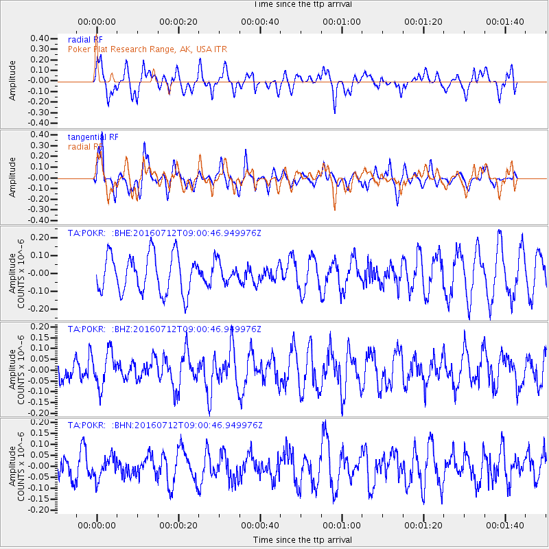
POKR Poker Plat Research Range, AK, USA - Earthquake Result Viewer
*The percent match for this event was below the threshold and hence no stack was calculated.
| Earthquake location: |
Eastern New Guinea Reg., P.N.G. |
| Earthquake latitude/longitude: |
-6.4/147.5 |
| Earthquake time(UTC): |
2016/07/12 (194) 08:48:44 GMT |
| Earthquake Depth: |
43 km |
| Earthquake Magnitude: |
5.6 MWW, 5.6 MWC |
| Earthquake Catalog/Contributor: |
NEIC PDE/NEIC COMCAT |
|
| Network: |
TA USArray Transportable Network (new EarthScope stations) |
| Station: |
POKR Poker Plat Research Range, AK, USA |
| Lat/Lon: |
65.12 N/147.43 W |
| Elevation: |
501 m |
|
| Distance: |
85.6 deg |
| Az: |
22.637 deg |
| Baz: |
244.696 deg |
| Ray Param: |
$rayparam |
*The percent match for this event was below the threshold and hence was not used in the summary stack. |
|
| Radial Match: |
58.232296 % |
| Radial Bump: |
400 |
| Transverse Match: |
57.835632 % |
| Transverse Bump: |
394 |
| SOD ConfigId: |
11737051 |
| Insert Time: |
2019-04-25 01:48:42.097 +0000 |
| GWidth: |
2.5 |
| Max Bumps: |
400 |
| Tol: |
0.001 |
|
Signal To Noise
| Channel | StoN | STA | LTA |
| TA:POKR: :BHZ:20160712T09:00:46.949976Z | 1.1256589 | 8.538604E-8 | 7.585428E-8 |
| TA:POKR: :BHN:20160712T09:00:46.949976Z | 0.73488116 | 4.976422E-8 | 6.771737E-8 |
| TA:POKR: :BHE:20160712T09:00:46.949976Z | 0.51738405 | 5.5862603E-8 | 1.0797125E-7 |
| Arrivals |
| Ps | |
| PpPs | |
| PsPs/PpSs | |


