You are here: Home > Network List > TA - USArray Transportable Network (new EarthScope stations) Stations List
> Station J26L Joseph Creek, AK, USA > Earthquake Result Viewer
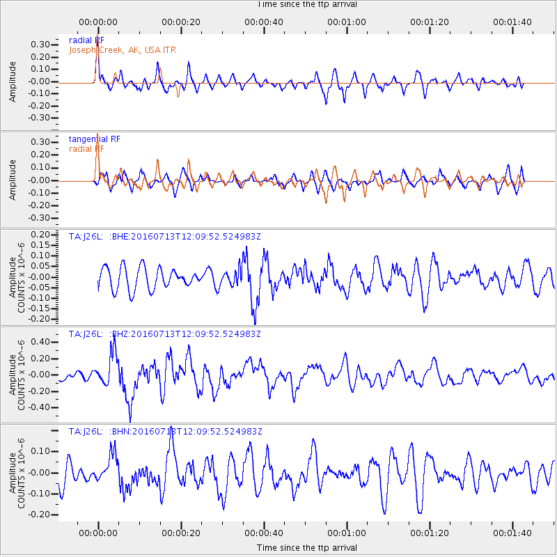
J26L Joseph Creek, AK, USA - Earthquake Result Viewer
*The percent match for this event was below the threshold and hence no stack was calculated.
| Earthquake location: |
Kermadec Islands Region |
| Earthquake latitude/longitude: |
-28.2/-176.3 |
| Earthquake time(UTC): |
2016/07/13 (195) 11:56:58 GMT |
| Earthquake Depth: |
17 km |
| Earthquake Magnitude: |
5.7 MB |
| Earthquake Catalog/Contributor: |
NEIC PDE/NEIC COMCAT |
|
| Network: |
TA USArray Transportable Network (new EarthScope stations) |
| Station: |
J26L Joseph Creek, AK, USA |
| Lat/Lon: |
64.50 N/143.56 W |
| Elevation: |
1144 m |
|
| Distance: |
95.9 deg |
| Az: |
13.618 deg |
| Baz: |
208.686 deg |
| Ray Param: |
$rayparam |
*The percent match for this event was below the threshold and hence was not used in the summary stack. |
|
| Radial Match: |
79.33418 % |
| Radial Bump: |
400 |
| Transverse Match: |
52.168476 % |
| Transverse Bump: |
400 |
| SOD ConfigId: |
11737051 |
| Insert Time: |
2019-04-25 01:56:59.104 +0000 |
| GWidth: |
2.5 |
| Max Bumps: |
400 |
| Tol: |
0.001 |
|
Signal To Noise
| Channel | StoN | STA | LTA |
| TA:J26L: :BHZ:20160713T12:09:52.524983Z | 3.3555481 | 2.0413347E-7 | 6.083461E-8 |
| TA:J26L: :BHN:20160713T12:09:52.524983Z | 1.1059998 | 6.678991E-8 | 6.0388714E-8 |
| TA:J26L: :BHE:20160713T12:09:52.524983Z | 0.81767875 | 4.0477854E-8 | 4.950337E-8 |
| Arrivals |
| Ps | |
| PpPs | |
| PsPs/PpSs | |


