You are here: Home > Network List > TA - USArray Transportable Network (new EarthScope stations) Stations List
> Station R17K Ugashik Creek, AK, USA > Earthquake Result Viewer
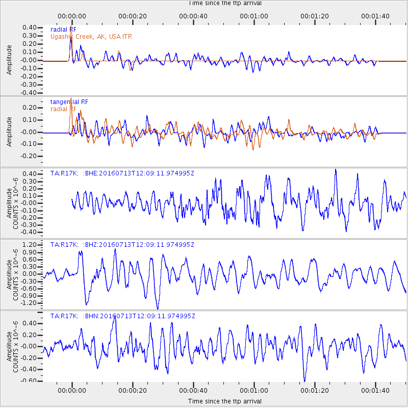
R17K Ugashik Creek, AK, USA - Earthquake Result Viewer
*The percent match for this event was below the threshold and hence no stack was calculated.
| Earthquake location: |
Kermadec Islands Region |
| Earthquake latitude/longitude: |
-28.2/-176.3 |
| Earthquake time(UTC): |
2016/07/13 (195) 11:56:58 GMT |
| Earthquake Depth: |
17 km |
| Earthquake Magnitude: |
5.7 MB |
| Earthquake Catalog/Contributor: |
NEIC PDE/NEIC COMCAT |
|
| Network: |
TA USArray Transportable Network (new EarthScope stations) |
| Station: |
R17K Ugashik Creek, AK, USA |
| Lat/Lon: |
57.64 N/156.39 W |
| Elevation: |
273 m |
|
| Distance: |
87.2 deg |
| Az: |
10.578 deg |
| Baz: |
197.53 deg |
| Ray Param: |
$rayparam |
*The percent match for this event was below the threshold and hence was not used in the summary stack. |
|
| Radial Match: |
74.61204 % |
| Radial Bump: |
400 |
| Transverse Match: |
65.491295 % |
| Transverse Bump: |
400 |
| SOD ConfigId: |
11737051 |
| Insert Time: |
2019-04-25 01:57:26.760 +0000 |
| GWidth: |
2.5 |
| Max Bumps: |
400 |
| Tol: |
0.001 |
|
Signal To Noise
| Channel | StoN | STA | LTA |
| TA:R17K: :BHZ:20160713T12:09:11.974995Z | 5.2175255 | 5.848288E-7 | 1.12089296E-7 |
| TA:R17K: :BHN:20160713T12:09:11.974995Z | 1.5552082 | 1.392232E-7 | 8.952062E-8 |
| TA:R17K: :BHE:20160713T12:09:11.974995Z | 1.6372921 | 1.2752392E-7 | 7.788709E-8 |
| Arrivals |
| Ps | |
| PpPs | |
| PsPs/PpSs | |


