You are here: Home > Network List > AK - Alaska Regional Network Stations List
> Station CUT Chulitna, AK, USA > Earthquake Result Viewer
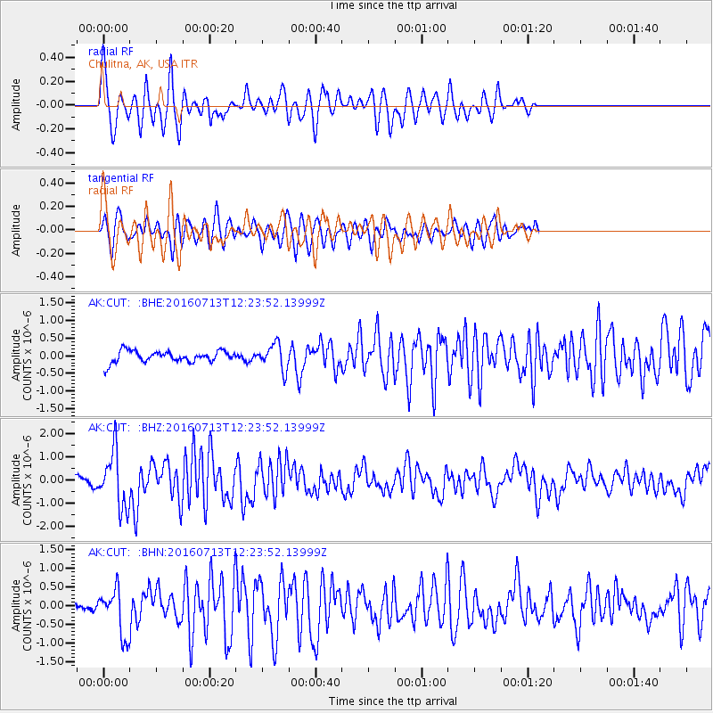
CUT Chulitna, AK, USA - Earthquake Result Viewer
*The percent match for this event was below the threshold and hence no stack was calculated.
| Earthquake location: |
Kermadec Islands Region |
| Earthquake latitude/longitude: |
-28.0/-176.4 |
| Earthquake time(UTC): |
2016/07/13 (195) 12:11:13 GMT |
| Earthquake Depth: |
12 km |
| Earthquake Magnitude: |
6.3 MWB |
| Earthquake Catalog/Contributor: |
NEIC PDE/NEIC COMCAT |
|
| Network: |
AK Alaska Regional Network |
| Station: |
CUT Chulitna, AK, USA |
| Lat/Lon: |
62.41 N/150.26 W |
| Elevation: |
574 m |
|
| Distance: |
92.5 deg |
| Az: |
11.843 deg |
| Baz: |
202.93 deg |
| Ray Param: |
$rayparam |
*The percent match for this event was below the threshold and hence was not used in the summary stack. |
|
| Radial Match: |
78.123726 % |
| Radial Bump: |
400 |
| Transverse Match: |
74.53745 % |
| Transverse Bump: |
400 |
| SOD ConfigId: |
11737051 |
| Insert Time: |
2019-04-25 02:00:56.435 +0000 |
| GWidth: |
2.5 |
| Max Bumps: |
400 |
| Tol: |
0.001 |
|
Signal To Noise
| Channel | StoN | STA | LTA |
| AK:CUT: :BHZ:20160713T12:23:52.13999Z | 6.4059963 | 1.2091559E-6 | 1.8875376E-7 |
| AK:CUT: :BHN:20160713T12:23:52.13999Z | 2.315012 | 6.4619786E-7 | 2.7913367E-7 |
| AK:CUT: :BHE:20160713T12:23:52.13999Z | 2.3678138 | 3.6857233E-7 | 1.5565932E-7 |
| Arrivals |
| Ps | |
| PpPs | |
| PsPs/PpSs | |


