You are here: Home > Network List > AK - Alaska Regional Network Stations List
> Station MDM Murphy Dome > Earthquake Result Viewer
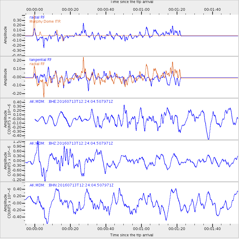
MDM Murphy Dome - Earthquake Result Viewer
*The percent match for this event was below the threshold and hence no stack was calculated.
| Earthquake location: |
Kermadec Islands Region |
| Earthquake latitude/longitude: |
-28.0/-176.4 |
| Earthquake time(UTC): |
2016/07/13 (195) 12:11:13 GMT |
| Earthquake Depth: |
12 km |
| Earthquake Magnitude: |
6.3 MWB |
| Earthquake Catalog/Contributor: |
NEIC PDE/NEIC COMCAT |
|
| Network: |
AK Alaska Regional Network |
| Station: |
MDM Murphy Dome |
| Lat/Lon: |
64.96 N/148.23 W |
| Elevation: |
634 m |
|
| Distance: |
95.2 deg |
| Az: |
11.635 deg |
| Baz: |
204.765 deg |
| Ray Param: |
$rayparam |
*The percent match for this event was below the threshold and hence was not used in the summary stack. |
|
| Radial Match: |
70.94352 % |
| Radial Bump: |
400 |
| Transverse Match: |
67.655235 % |
| Transverse Bump: |
400 |
| SOD ConfigId: |
11737051 |
| Insert Time: |
2019-04-25 02:01:21.701 +0000 |
| GWidth: |
2.5 |
| Max Bumps: |
400 |
| Tol: |
0.001 |
|
Signal To Noise
| Channel | StoN | STA | LTA |
| AK:MDM: :BHZ:20160713T12:24:04.507971Z | 5.6219587 | 6.1883463E-7 | 1.1007455E-7 |
| AK:MDM: :BHN:20160713T12:24:04.507971Z | 0.5407068 | 9.778998E-8 | 1.8085582E-7 |
| AK:MDM: :BHE:20160713T12:24:04.507971Z | 1.3910533 | 1.1903887E-7 | 8.5574634E-8 |
| Arrivals |
| Ps | |
| PpPs | |
| PsPs/PpSs | |


