BMO Blue Mountains Array (Baker), Oregon, USA - Earthquake Result Viewer
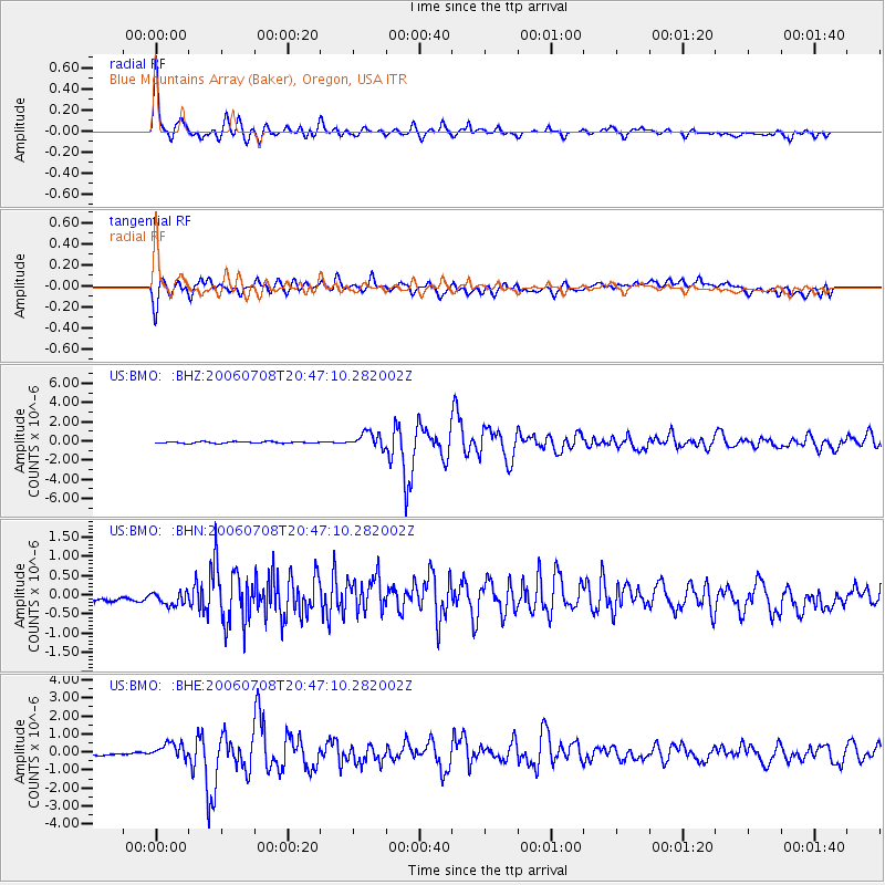
Earthquake location: Andreanof Islands, Aleutian Is.
Earthquake latitude/longitude: 51.2/-179.3
Earthquake time(UTC): 2006/07/08 (189) 20:40:00 GMT
Earthquake Depth: 22 km
Earthquake Magnitude: 6.2 MB, 6.4 MS, 6.6 MW, 6.6 MW
Earthquake Catalog/Contributor: WHDF/NEIC
Network: US United States National Seismic Network
Station: BMO Blue Mountains Array (Baker), Oregon, USA
Lat/Lon: 44.85 N/117.31 W
Elevation: 1189 m
Distance: 40.9 deg
Az: 73.798 deg
Baz: 301.887 deg
Ray Param: 0.07412447
Estimated Moho Depth: 28.25 km
Estimated Crust Vp/Vs: 1.69
Assumed Crust Vp: 6.571 km/s
Estimated Crust Vs: 3.882 km/s
Estimated Crust Poisson's Ratio: 0.23
Radial Match: 95.39358 %
Radial Bump: 400
Transverse Match: 75.356064 %
Transverse Bump: 400
SOD ConfigId: 5423
Insert Time: 2010-03-05 05:19:57.930 +0000
GWidth: 2.5
Max Bumps: 400
Tol: 0.001

Signal To Noise

ChannelStoNSTALTA
US:BMO: :BHN:20060708T20:47:10.282002Z1.17196242.4336558E-72.0765648E-7
US:BMO: :BHE:20060708T20:47:10.282002Z1.70933493.481888E-72.036984E-7
US:BMO: :BHZ:20060708T20:47:10.282002Z9.7733887.855182E-78.037318E-8
Arrivals
Ps3.2 SECOND
PpPs11 SECOND
PsPs/PpSs14 SECOND