You are here: Home > Network List > US - United States National Seismic Network Stations List
> Station AMTX Amarillo, Texas, USA > Earthquake Result Viewer
AMTX Amarillo, Texas, USA - Earthquake Result Viewer
*The percent match for this event was below the threshold and hence no stack was calculated.
| Earthquake location: |
Northern Mid-Atlantic Ridge |
| Earthquake latitude/longitude: |
35.2/-35.2 |
| Earthquake time(UTC): |
2016/07/15 (197) 18:02:49 GMT |
| Earthquake Depth: |
16 km |
| Earthquake Magnitude: |
5.5 mwb |
| Earthquake Catalog/Contributor: |
NEIC PDE/ |
|
| Network: |
US United States National Seismic Network |
| Station: |
AMTX Amarillo, Texas, USA |
| Lat/Lon: |
34.53 N/101.41 W |
| Elevation: |
1010 m |
|
| Distance: |
53.4 deg |
| Az: |
289.719 deg |
| Baz: |
69.019 deg |
| Ray Param: |
$rayparam |
*The percent match for this event was below the threshold and hence was not used in the summary stack. |
|
| Radial Match: |
51.16326 % |
| Radial Bump: |
400 |
| Transverse Match: |
60.80728 % |
| Transverse Bump: |
400 |
| SOD ConfigId: |
11737051 |
| Insert Time: |
2019-04-25 02:39:09.527 +0000 |
| GWidth: |
2.5 |
| Max Bumps: |
400 |
| Tol: |
0.001 |
|
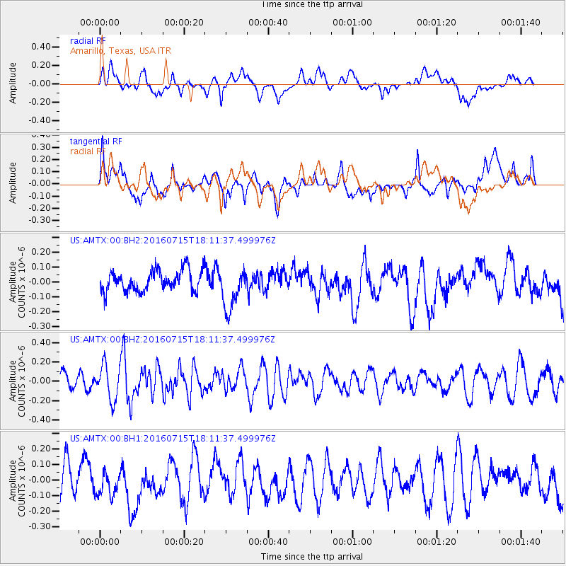
Signal To Noise
| Channel | StoN | STA | LTA |
| US:AMTX:00:BHZ:20160715T18:11:37.499976Z | 1.9140384 | 1.856746E-7 | 9.7006726E-8 |
| US:AMTX:00:BH1:20160715T18:11:37.499976Z | 1.0533293 | 1.0356713E-7 | 9.83236E-8 |
| US:AMTX:00:BH2:20160715T18:11:37.499976Z | 2.140054 | 1.4572593E-7 | 6.8094515E-8 |
| Arrivals |
| Ps | |
| PpPs | |
| PsPs/PpSs | |


