You are here: Home > Network List > TA - USArray Transportable Network (new EarthScope stations) Stations List
> Station L44A Lake County Forest Preserve, Grayslake, IL, USA > Earthquake Result Viewer
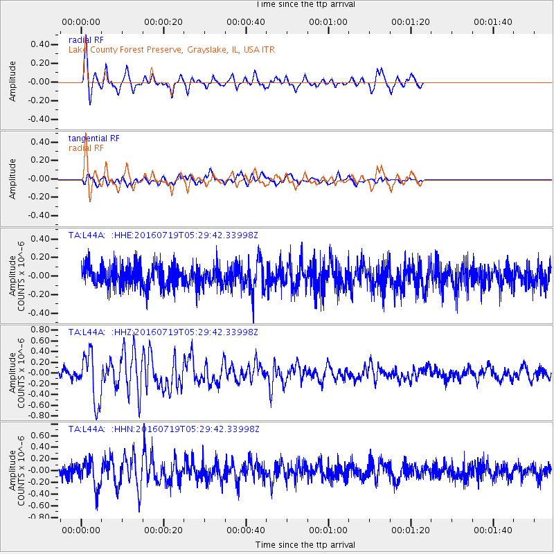
L44A Lake County Forest Preserve, Grayslake, IL, USA - Earthquake Result Viewer
*The percent match for this event was below the threshold and hence no stack was calculated.
| Earthquake location: |
Off Coast Of Central Chile |
| Earthquake latitude/longitude: |
-30.2/-72.0 |
| Earthquake time(UTC): |
2016/07/19 (201) 05:18:40 GMT |
| Earthquake Depth: |
14 km |
| Earthquake Magnitude: |
5.5 MB |
| Earthquake Catalog/Contributor: |
NEIC PDE/NEIC COMCAT |
|
| Network: |
TA USArray Transportable Network (new EarthScope stations) |
| Station: |
L44A Lake County Forest Preserve, Grayslake, IL, USA |
| Lat/Lon: |
42.18 N/87.91 W |
| Elevation: |
202 m |
|
| Distance: |
73.5 deg |
| Az: |
347.745 deg |
| Baz: |
165.684 deg |
| Ray Param: |
$rayparam |
*The percent match for this event was below the threshold and hence was not used in the summary stack. |
|
| Radial Match: |
84.05862 % |
| Radial Bump: |
312 |
| Transverse Match: |
54.007862 % |
| Transverse Bump: |
400 |
| SOD ConfigId: |
11737051 |
| Insert Time: |
2019-04-25 02:48:59.608 +0000 |
| GWidth: |
2.5 |
| Max Bumps: |
400 |
| Tol: |
0.001 |
|
Signal To Noise
| Channel | StoN | STA | LTA |
| TA:L44A: :HHZ:20160719T05:29:42.33998Z | 5.6762357 | 4.6225625E-7 | 8.1437115E-8 |
| TA:L44A: :HHN:20160719T05:29:42.33998Z | 2.2276204 | 2.3552829E-7 | 1.057309E-7 |
| TA:L44A: :HHE:20160719T05:29:42.33998Z | 0.9102001 | 1.0958279E-7 | 1.2039418E-7 |
| Arrivals |
| Ps | |
| PpPs | |
| PsPs/PpSs | |


