You are here: Home > Network List > TA - USArray Transportable Network (new EarthScope stations) Stations List
> Station M53A WI Miller and Sons, Farmdale, OH, USA > Earthquake Result Viewer
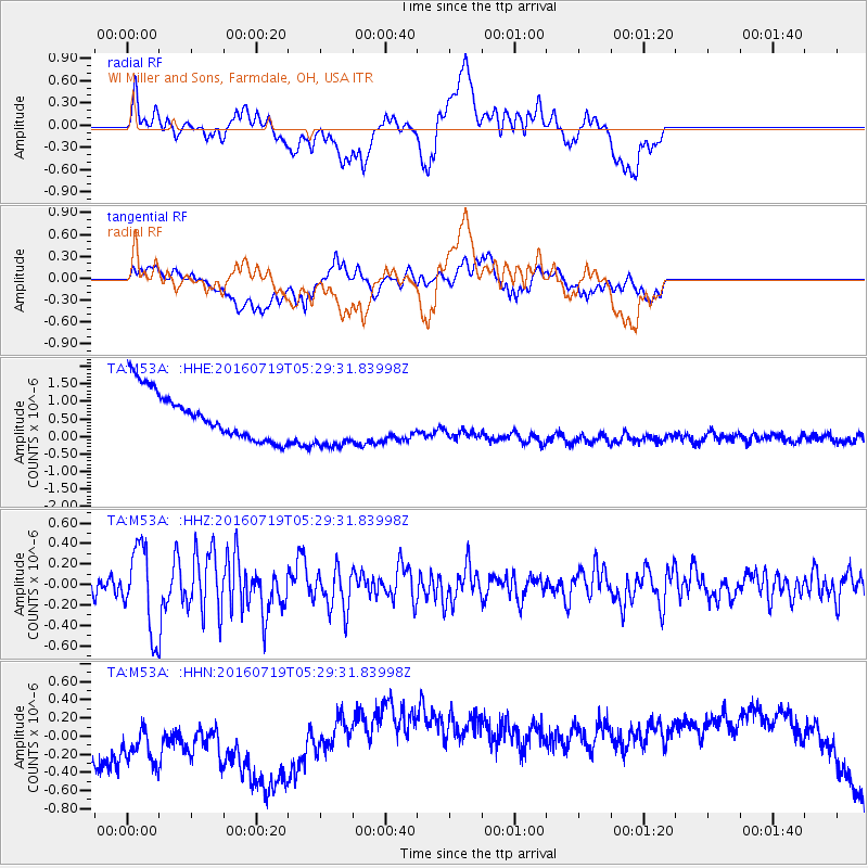
M53A WI Miller and Sons, Farmdale, OH, USA - Earthquake Result Viewer
*The percent match for this event was below the threshold and hence no stack was calculated.
| Earthquake location: |
Off Coast Of Central Chile |
| Earthquake latitude/longitude: |
-30.2/-72.0 |
| Earthquake time(UTC): |
2016/07/19 (201) 05:18:40 GMT |
| Earthquake Depth: |
14 km |
| Earthquake Magnitude: |
5.5 MB |
| Earthquake Catalog/Contributor: |
NEIC PDE/NEIC COMCAT |
|
| Network: |
TA USArray Transportable Network (new EarthScope stations) |
| Station: |
M53A WI Miller and Sons, Farmdale, OH, USA |
| Lat/Lon: |
41.44 N/80.68 W |
| Elevation: |
334 m |
|
| Distance: |
71.7 deg |
| Az: |
353.158 deg |
| Baz: |
172.115 deg |
| Ray Param: |
$rayparam |
*The percent match for this event was below the threshold and hence was not used in the summary stack. |
|
| Radial Match: |
10.521092 % |
| Radial Bump: |
400 |
| Transverse Match: |
5.833735 % |
| Transverse Bump: |
400 |
| SOD ConfigId: |
11737051 |
| Insert Time: |
2019-04-25 02:49:00.293 +0000 |
| GWidth: |
2.5 |
| Max Bumps: |
400 |
| Tol: |
0.001 |
|
Signal To Noise
| Channel | StoN | STA | LTA |
| TA:M53A: :HHZ:20160719T05:29:31.83998Z | 3.951643 | 4.0712337E-7 | 1.0302635E-7 |
| TA:M53A: :HHN:20160719T05:29:31.83998Z | 0.6592805 | 8.7937116E-7 | 1.3338347E-6 |
| TA:M53A: :HHE:20160719T05:29:31.83998Z | 1.2808324 | 8.53447E-7 | 6.6632214E-7 |
| Arrivals |
| Ps | |
| PpPs | |
| PsPs/PpSs | |


