NLWA Neilton Lookout, Washington, USA - Earthquake Result Viewer
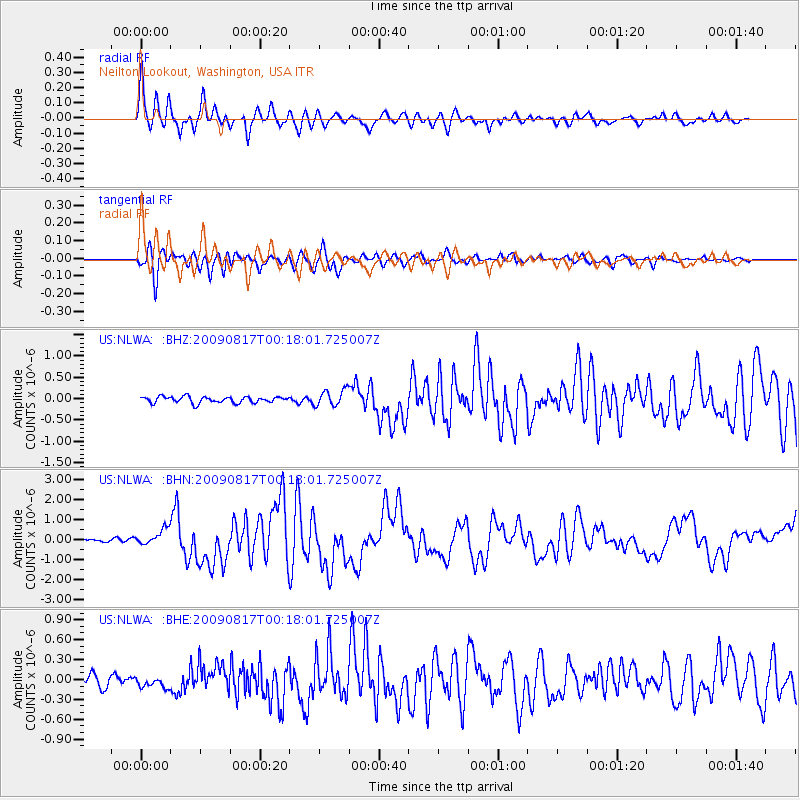
Earthquake location: Southwestern Ryukyu Isl., Japan
Earthquake latitude/longitude: 23.5/123.5
Earthquake time(UTC): 2009/08/17 (229) 00:05:49 GMT
Earthquake Depth: 20 km
Earthquake Magnitude: 6.2 MB, 6.6 MS, 6.7 MW, 6.6 MW
Earthquake Catalog/Contributor: WHDF/NEIC
Network: US United States National Seismic Network
Station: NLWA Neilton Lookout, Washington, USA
Lat/Lon: 47.39 N/123.87 W
Elevation: 610 m
Distance: 87.1 deg
Az: 38.9 deg
Baz: 301.957 deg
Ray Param: 0.04356383
Estimated Moho Depth: 50.75 km
Estimated Crust Vp/Vs: 1.60
Assumed Crust Vp: 6.566 km/s
Estimated Crust Vs: 4.104 km/s
Estimated Crust Poisson's Ratio: 0.18
Radial Match: 92.75547 %
Radial Bump: 400
Transverse Match: 88.312096 %
Transverse Bump: 400
SOD ConfigId: 2622
Insert Time: 2010-03-05 05:25:11.939 +0000
GWidth: 2.5
Max Bumps: 400
Tol: 0.001

Signal To Noise

ChannelStoNSTALTA
US:NLWA: :BHN:20090817T00:18:01.725007Z4.2018853.9732E-79.4557564E-8
US:NLWA: :BHE:20090817T00:18:01.725007Z0.886040038.309598E-89.378355E-8
US:NLWA: :BHZ:20090817T00:18:01.725007Z2.58540251.8925532E-77.320149E-8
Arrivals
Ps4.8 SECOND
PpPs20 SECOND
PsPs/PpSs24 SECOND