You are here: Home > Network List > CI - Caltech Regional Seismic Network Stations List
> Station MPM Manuel Prospect Mine, California, USA > Earthquake Result Viewer
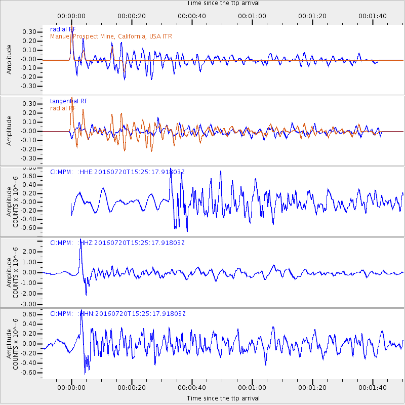
MPM Manuel Prospect Mine, California, USA - Earthquake Result Viewer
*The percent match for this event was below the threshold and hence no stack was calculated.
| Earthquake location: |
Vanuatu Islands |
| Earthquake latitude/longitude: |
-18.9/169.0 |
| Earthquake time(UTC): |
2016/07/20 (202) 15:13:16 GMT |
| Earthquake Depth: |
164 km |
| Earthquake Magnitude: |
6.0 MO |
| Earthquake Catalog/Contributor: |
NEIC PDE/NEIC ALERT |
|
| Network: |
CI Caltech Regional Seismic Network |
| Station: |
MPM Manuel Prospect Mine, California, USA |
| Lat/Lon: |
36.06 N/117.49 W |
| Elevation: |
185 m |
|
| Distance: |
88.3 deg |
| Az: |
51.004 deg |
| Baz: |
245.24 deg |
| Ray Param: |
$rayparam |
*The percent match for this event was below the threshold and hence was not used in the summary stack. |
|
| Radial Match: |
79.06708 % |
| Radial Bump: |
400 |
| Transverse Match: |
71.65305 % |
| Transverse Bump: |
400 |
| SOD ConfigId: |
11737051 |
| Insert Time: |
2019-04-25 02:55:28.442 +0000 |
| GWidth: |
2.5 |
| Max Bumps: |
400 |
| Tol: |
0.001 |
|
Signal To Noise
| Channel | StoN | STA | LTA |
| CI:MPM: :HHZ:20160720T15:25:17.91803Z | 9.515796 | 1.0496889E-6 | 1.10310154E-7 |
| CI:MPM: :HHN:20160720T15:25:17.91803Z | 4.4103537 | 2.763575E-7 | 6.266108E-8 |
| CI:MPM: :HHE:20160720T15:25:17.91803Z | 2.298451 | 3.0413563E-7 | 1.32322E-7 |
| Arrivals |
| Ps | |
| PpPs | |
| PsPs/PpSs | |


