You are here: Home > Network List > TA - USArray Transportable Network (new EarthScope stations) Stations List
> Station 121A Cookes Peak, Deming, NM, USA > Earthquake Result Viewer
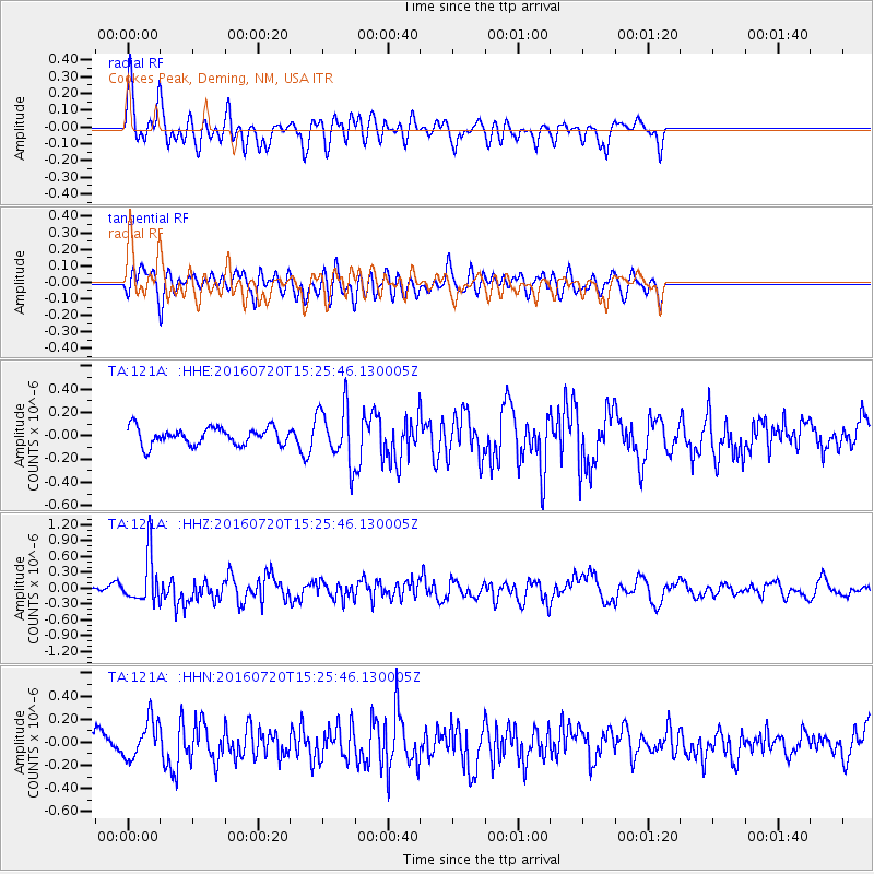
121A Cookes Peak, Deming, NM, USA - Earthquake Result Viewer
*The percent match for this event was below the threshold and hence no stack was calculated.
| Earthquake location: |
Vanuatu Islands |
| Earthquake latitude/longitude: |
-18.9/169.0 |
| Earthquake time(UTC): |
2016/07/20 (202) 15:13:16 GMT |
| Earthquake Depth: |
164 km |
| Earthquake Magnitude: |
6.0 MO |
| Earthquake Catalog/Contributor: |
NEIC PDE/NEIC ALERT |
|
| Network: |
TA USArray Transportable Network (new EarthScope stations) |
| Station: |
121A Cookes Peak, Deming, NM, USA |
| Lat/Lon: |
32.53 N/107.79 W |
| Elevation: |
1652 m |
|
| Distance: |
94.4 deg |
| Az: |
57.275 deg |
| Baz: |
250.543 deg |
| Ray Param: |
$rayparam |
*The percent match for this event was below the threshold and hence was not used in the summary stack. |
|
| Radial Match: |
60.162357 % |
| Radial Bump: |
400 |
| Transverse Match: |
49.836346 % |
| Transverse Bump: |
400 |
| SOD ConfigId: |
11737051 |
| Insert Time: |
2019-04-25 02:58:30.827 +0000 |
| GWidth: |
2.5 |
| Max Bumps: |
400 |
| Tol: |
0.001 |
|
Signal To Noise
| Channel | StoN | STA | LTA |
| TA:121A: :HHZ:20160720T15:25:46.130005Z | 3.3483422 | 4.4183278E-7 | 1.3195569E-7 |
| TA:121A: :HHN:20160720T15:25:46.130005Z | 1.90857 | 1.6495721E-7 | 8.6429736E-8 |
| TA:121A: :HHE:20160720T15:25:46.130005Z | 3.1778564 | 2.3727327E-7 | 7.466457E-8 |
| Arrivals |
| Ps | |
| PpPs | |
| PsPs/PpSs | |


