You are here: Home > Network List > AZ - ANZA Regional Network Stations List
> Station SMER AZ.SMER > Earthquake Result Viewer
SMER AZ.SMER - Earthquake Result Viewer
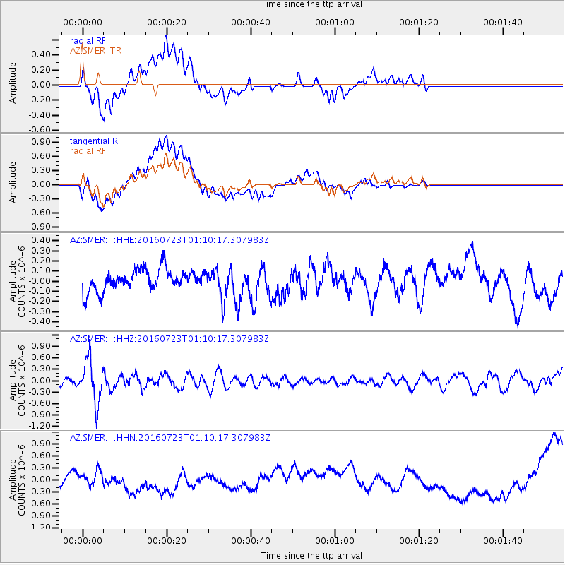
*The percent match for this event was below the threshold and hence no stack was calculated.
| Earthquake location: |
Northwest Of Kuril Islands |
| Earthquake latitude/longitude: |
47.7/147.0 |
| Earthquake time(UTC): |
2016/07/23 (205) 01:00:21 GMT |
| Earthquake Depth: |
407 km |
| Earthquake Magnitude: |
5.7 MB |
| Earthquake Catalog/Contributor: |
NEIC PDE/NEIC ALERT |
|
| Network: |
AZ ANZA Regional Network |
| Station: |
SMER AZ.SMER |
| Lat/Lon: |
33.46 N/117.17 W |
| Elevation: |
355 m |
|
| Distance: |
69.7 deg |
| Az: |
62.454 deg |
| Baz: |
314.249 deg |
| Ray Param: |
$rayparam |
*The percent match for this event was below the threshold and hence was not used in the summary stack. |
|
| Radial Match: |
29.022852 % |
| Radial Bump: |
400 |
| Transverse Match: |
35.52697 % |
| Transverse Bump: |
400 |
| SOD ConfigId: |
11737051 |
| Insert Time: |
2019-04-25 03:06:14.687 +0000 |
| GWidth: |
2.5 |
| Max Bumps: |
400 |
| Tol: |
0.001 |
|
Signal To Noise
| Channel | StoN | STA | LTA |
| AZ:SMER: :HHZ:20160723T01:10:17.307983Z | 5.8719645 | 5.5115447E-7 | 9.386203E-8 |
| AZ:SMER: :HHN:20160723T01:10:17.307983Z | 0.7486473 | 1.6105409E-7 | 2.1512679E-7 |
| AZ:SMER: :HHE:20160723T01:10:17.307983Z | 1.3029922 | 1.3972644E-7 | 1.0723505E-7 |
| Arrivals |
| Ps | |
| PpPs | |
| PsPs/PpSs | |


