You are here: Home > Network List > CI - Caltech Regional Seismic Network Stations List
> Station DAN Danby, California, USA > Earthquake Result Viewer
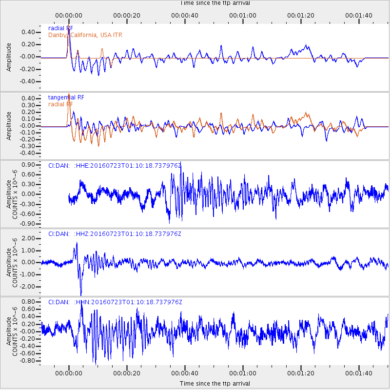
DAN Danby, California, USA - Earthquake Result Viewer
*The percent match for this event was below the threshold and hence no stack was calculated.
| Earthquake location: |
Northwest Of Kuril Islands |
| Earthquake latitude/longitude: |
47.7/147.0 |
| Earthquake time(UTC): |
2016/07/23 (205) 01:00:21 GMT |
| Earthquake Depth: |
407 km |
| Earthquake Magnitude: |
5.7 MB |
| Earthquake Catalog/Contributor: |
NEIC PDE/NEIC ALERT |
|
| Network: |
CI Caltech Regional Seismic Network |
| Station: |
DAN Danby, California, USA |
| Lat/Lon: |
34.64 N/115.38 W |
| Elevation: |
398 m |
|
| Distance: |
69.9 deg |
| Az: |
60.451 deg |
| Baz: |
314.556 deg |
| Ray Param: |
$rayparam |
*The percent match for this event was below the threshold and hence was not used in the summary stack. |
|
| Radial Match: |
75.88294 % |
| Radial Bump: |
400 |
| Transverse Match: |
68.079666 % |
| Transverse Bump: |
400 |
| SOD ConfigId: |
11737051 |
| Insert Time: |
2019-04-25 03:07:00.449 +0000 |
| GWidth: |
2.5 |
| Max Bumps: |
400 |
| Tol: |
0.001 |
|
Signal To Noise
| Channel | StoN | STA | LTA |
| CI:DAN: :HHZ:20160723T01:10:18.737976Z | 8.614072 | 9.740082E-7 | 1.1307175E-7 |
| CI:DAN: :HHN:20160723T01:10:18.737976Z | 2.5637228 | 3.196993E-7 | 1.2470119E-7 |
| CI:DAN: :HHE:20160723T01:10:18.737976Z | 2.100718 | 3.0492163E-7 | 1.4515113E-7 |
| Arrivals |
| Ps | |
| PpPs | |
| PsPs/PpSs | |


