You are here: Home > Network List > CI - Caltech Regional Seismic Network Stations List
> Station MPM Manuel Prospect Mine, California, USA > Earthquake Result Viewer
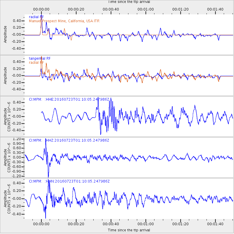
MPM Manuel Prospect Mine, California, USA - Earthquake Result Viewer
*The percent match for this event was below the threshold and hence no stack was calculated.
| Earthquake location: |
Northwest Of Kuril Islands |
| Earthquake latitude/longitude: |
47.7/147.0 |
| Earthquake time(UTC): |
2016/07/23 (205) 01:00:21 GMT |
| Earthquake Depth: |
407 km |
| Earthquake Magnitude: |
5.7 MB |
| Earthquake Catalog/Contributor: |
NEIC PDE/NEIC ALERT |
|
| Network: |
CI Caltech Regional Seismic Network |
| Station: |
MPM Manuel Prospect Mine, California, USA |
| Lat/Lon: |
36.06 N/117.49 W |
| Elevation: |
185 m |
|
| Distance: |
67.7 deg |
| Az: |
60.641 deg |
| Baz: |
313.41 deg |
| Ray Param: |
$rayparam |
*The percent match for this event was below the threshold and hence was not used in the summary stack. |
|
| Radial Match: |
64.4772 % |
| Radial Bump: |
400 |
| Transverse Match: |
63.26994 % |
| Transverse Bump: |
400 |
| SOD ConfigId: |
11737051 |
| Insert Time: |
2019-04-25 03:07:16.208 +0000 |
| GWidth: |
2.5 |
| Max Bumps: |
400 |
| Tol: |
0.001 |
|
Signal To Noise
| Channel | StoN | STA | LTA |
| CI:MPM: :HHZ:20160723T01:10:05.247986Z | 4.484647 | 5.0355123E-7 | 1.1228335E-7 |
| CI:MPM: :HHN:20160723T01:10:05.247986Z | 2.6393704 | 2.3706939E-7 | 8.9820425E-8 |
| CI:MPM: :HHE:20160723T01:10:05.247986Z | 2.220899 | 2.2066399E-7 | 9.9357955E-8 |
| Arrivals |
| Ps | |
| PpPs | |
| PsPs/PpSs | |


