You are here: Home > Network List > CI - Caltech Regional Seismic Network Stations List
> Station SMM Simmler, CA, USA > Earthquake Result Viewer
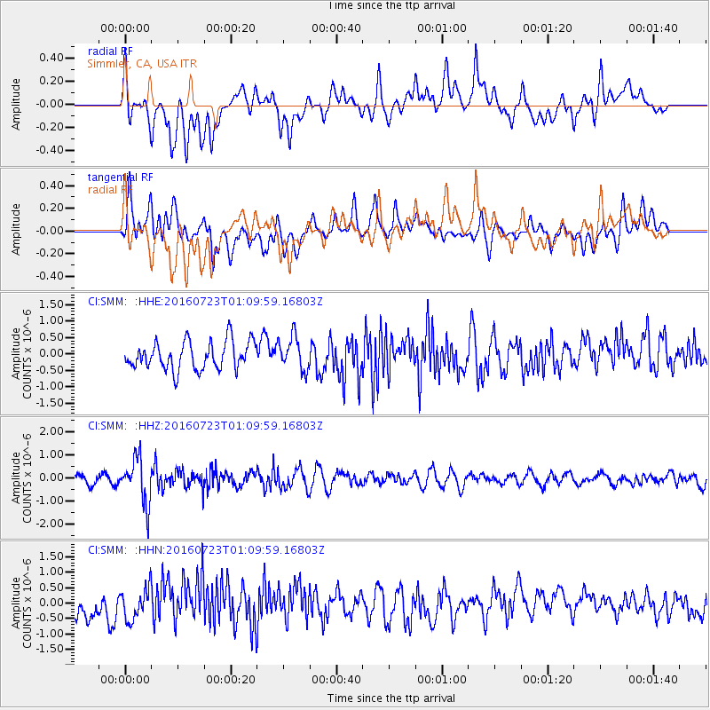
SMM Simmler, CA, USA - Earthquake Result Viewer
*The percent match for this event was below the threshold and hence no stack was calculated.
| Earthquake location: |
Northwest Of Kuril Islands |
| Earthquake latitude/longitude: |
47.7/147.0 |
| Earthquake time(UTC): |
2016/07/23 (205) 01:00:21 GMT |
| Earthquake Depth: |
407 km |
| Earthquake Magnitude: |
5.7 MB |
| Earthquake Catalog/Contributor: |
NEIC PDE/NEIC ALERT |
|
| Network: |
CI Caltech Regional Seismic Network |
| Station: |
SMM Simmler, CA, USA |
| Lat/Lon: |
35.31 N/120.00 W |
| Elevation: |
599 m |
|
| Distance: |
66.7 deg |
| Az: |
62.74 deg |
| Baz: |
312.767 deg |
| Ray Param: |
$rayparam |
*The percent match for this event was below the threshold and hence was not used in the summary stack. |
|
| Radial Match: |
56.993904 % |
| Radial Bump: |
400 |
| Transverse Match: |
56.674545 % |
| Transverse Bump: |
400 |
| SOD ConfigId: |
11737051 |
| Insert Time: |
2019-04-25 03:07:27.690 +0000 |
| GWidth: |
2.5 |
| Max Bumps: |
400 |
| Tol: |
0.001 |
|
Signal To Noise
| Channel | StoN | STA | LTA |
| CI:SMM: :HHZ:20160723T01:09:59.16803Z | 5.5591373 | 9.920616E-7 | 1.7845603E-7 |
| CI:SMM: :HHN:20160723T01:09:59.16803Z | 1.2475572 | 5.1106514E-7 | 4.096527E-7 |
| CI:SMM: :HHE:20160723T01:09:59.16803Z | 1.1955286 | 5.0961546E-7 | 4.262679E-7 |
| Arrivals |
| Ps | |
| PpPs | |
| PsPs/PpSs | |


