You are here: Home > Network List > KN - Kyrgyz Seismic Telemetry Network Stations List
> Station CHM KN.CHM > Earthquake Result Viewer
CHM KN.CHM - Earthquake Result Viewer
*The percent match for this event was below the threshold and hence no stack was calculated.
| Earthquake location: |
Northwest Of Kuril Islands |
| Earthquake latitude/longitude: |
47.7/147.0 |
| Earthquake time(UTC): |
2016/07/23 (205) 01:00:21 GMT |
| Earthquake Depth: |
407 km |
| Earthquake Magnitude: |
5.7 MB |
| Earthquake Catalog/Contributor: |
NEIC PDE/NEIC ALERT |
|
| Network: |
KN Kyrgyz Seismic Telemetry Network |
| Station: |
CHM KN.CHM |
| Lat/Lon: |
43.00 N/74.75 E |
| Elevation: |
655 m |
|
| Distance: |
49.3 deg |
| Az: |
292.795 deg |
| Baz: |
58.069 deg |
| Ray Param: |
$rayparam |
*The percent match for this event was below the threshold and hence was not used in the summary stack. |
|
| Radial Match: |
21.645145 % |
| Radial Bump: |
400 |
| Transverse Match: |
27.046095 % |
| Transverse Bump: |
400 |
| SOD ConfigId: |
11737051 |
| Insert Time: |
2019-04-25 03:10:07.120 +0000 |
| GWidth: |
2.5 |
| Max Bumps: |
400 |
| Tol: |
0.001 |
|
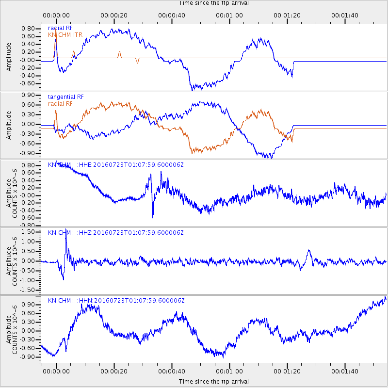
Signal To Noise
| Channel | StoN | STA | LTA |
| KN:CHM: :HHZ:20160723T01:07:59.600006Z | 12.097555 | 5.3138194E-7 | 4.392474E-8 |
| KN:CHM: :HHN:20160723T01:07:59.600006Z | 1.5888453 | 8.5842595E-7 | 5.402829E-7 |
| KN:CHM: :HHE:20160723T01:07:59.600006Z | 0.92477804 | 3.3166322E-7 | 3.586409E-7 |
| Arrivals |
| Ps | |
| PpPs | |
| PsPs/PpSs | |


