CBKS Cedar Bluff, Kansas, USA - Earthquake Result Viewer
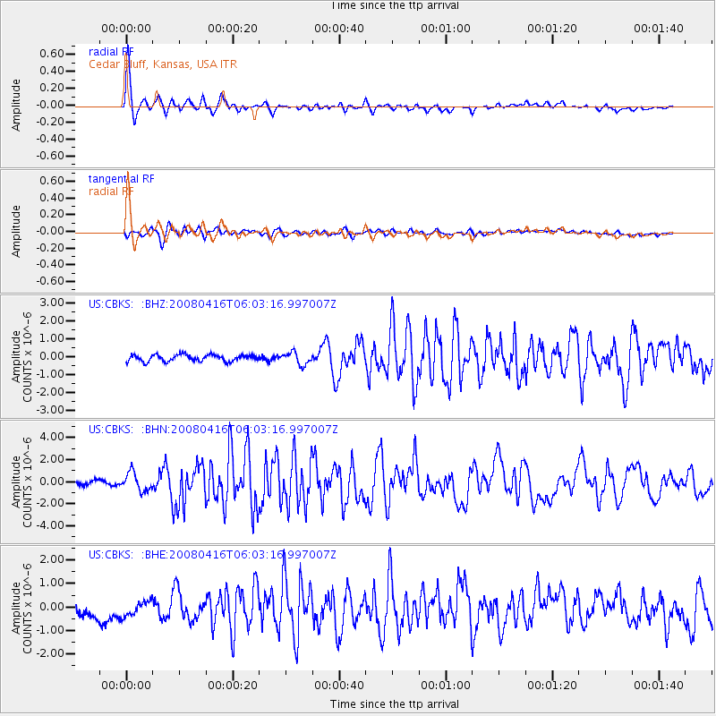
Earthquake location: Andreanof Islands, Aleutian Is.
Earthquake latitude/longitude: 51.9/-179.2
Earthquake time(UTC): 2008/04/16 (107) 05:54:19 GMT
Earthquake Depth: 13 km
Earthquake Magnitude: 6.1 MB, 6.5 MS, 6.6 MW, 6.6 MW
Earthquake Catalog/Contributor: WHDF/NEIC
Network: US United States National Seismic Network
Station: CBKS Cedar Bluff, Kansas, USA
Lat/Lon: 38.81 N/99.74 W
Elevation: 677 m
Distance: 54.6 deg
Az: 70.332 deg
Baz: 311.652 deg
Ray Param: 0.06531359
Estimated Moho Depth: 42.5 km
Estimated Crust Vp/Vs: 1.87
Assumed Crust Vp: 6.483 km/s
Estimated Crust Vs: 3.471 km/s
Estimated Crust Poisson's Ratio: 0.30
Radial Match: 94.4206 %
Radial Bump: 400
Transverse Match: 82.737724 %
Transverse Bump: 400
SOD ConfigId: 2504
Insert Time: 2010-03-05 05:29:05.773 +0000
GWidth: 2.5
Max Bumps: 400
Tol: 0.001

Signal To Noise

ChannelStoNSTALTA
US:CBKS: :BHN:20080416T06:03:16.997007Z6.1107838.373051E-71.3702092E-7
US:CBKS: :BHE:20080416T06:03:16.997007Z1.36942533.4113708E-72.4910966E-7
US:CBKS: :BHZ:20080416T06:03:16.997007Z1.89272673.4475045E-71.8214486E-7
Arrivals
Ps6.0 SECOND
PpPs18 SECOND
PsPs/PpSs24 SECOND