CBKS Cedar Bluff, Kansas, USA - Earthquake Result Viewer
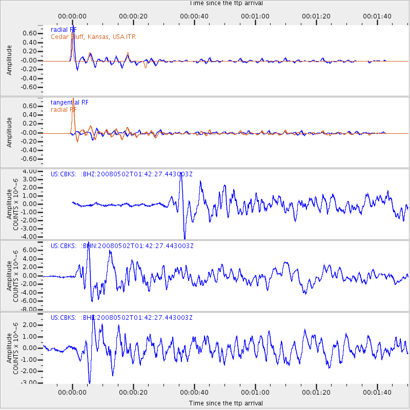
Earthquake location: Andreanof Islands, Aleutian Is.
Earthquake latitude/longitude: 51.9/-177.5
Earthquake time(UTC): 2008/05/02 (123) 01:33:37 GMT
Earthquake Depth: 14 km
Earthquake Magnitude: 6.3 MB, 6.8 MS, 6.6 MW, 6.6 MW
Earthquake Catalog/Contributor: WHDF/NEIC
Network: US United States National Seismic Network
Station: CBKS Cedar Bluff, Kansas, USA
Lat/Lon: 38.81 N/99.74 W
Elevation: 677 m
Distance: 53.7 deg
Az: 71.366 deg
Baz: 311.225 deg
Ray Param: 0.06592236
Estimated Moho Depth: 10.0 km
Estimated Crust Vp/Vs: 1.60
Assumed Crust Vp: 6.483 km/s
Estimated Crust Vs: 4.052 km/s
Estimated Crust Poisson's Ratio: 0.18
Radial Match: 97.59234 %
Radial Bump: 339
Transverse Match: 82.30353 %
Transverse Bump: 400
SOD ConfigId: 2504
Insert Time: 2010-03-05 05:29:07.973 +0000
GWidth: 2.5
Max Bumps: 400
Tol: 0.001

Signal To Noise

ChannelStoNSTALTA
US:CBKS: :BHN:20080502T01:42:27.443003Z11.761891.4575295E-61.2391966E-7
US:CBKS: :BHE:20080502T01:42:27.443003Z3.15624674.5531033E-71.4425689E-7
US:CBKS: :BHZ:20080502T01:42:27.443003Z4.04156734.4301115E-71.09613694E-7
Arrivals
Ps1.0 SECOND
PpPs3.8 SECOND
PsPs/PpSs4.8 SECOND