CBKS Cedar Bluff, Kansas, USA - Earthquake Result Viewer
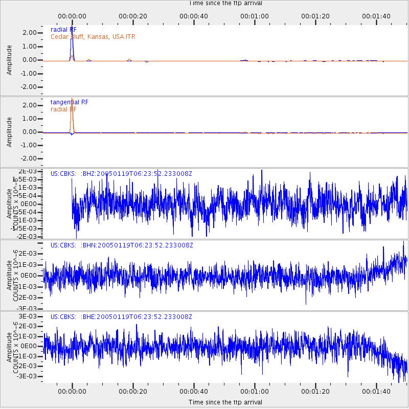
Earthquake location: Off East Coast Of Honshu, Japan
Earthquake latitude/longitude: 34.1/141.5
Earthquake time(UTC): 2005/01/19 (019) 06:11:36 GMT
Earthquake Depth: 28 km
Earthquake Magnitude: 5.8 MB, 6.4 MS, 6.5 MW, 6.4 MW
Earthquake Catalog/Contributor: WHDF/NEIC
Network: US United States National Seismic Network
Station: CBKS Cedar Bluff, Kansas, USA
Lat/Lon: 38.81 N/99.74 W
Elevation: 677 m
Distance: 87.9 deg
Az: 43.254 deg
Baz: 313.27 deg
Ray Param: 0.042921375
Estimated Moho Depth: 10.0 km
Estimated Crust Vp/Vs: 1.60
Assumed Crust Vp: 6.483 km/s
Estimated Crust Vs: 4.052 km/s
Estimated Crust Poisson's Ratio: 0.18
Radial Match: 99.208435 %
Radial Bump: 49
Transverse Match: 72.79994 %
Transverse Bump: 266
SOD ConfigId: 110165
Insert Time: 2010-03-05 05:29:59.273 +0000
GWidth: 2.5
Max Bumps: 400
Tol: 0.001

Signal To Noise

ChannelStoNSTALTA
US:CBKS: :BHN:20050119T06:23:52.233008Z0.93983535.537108E-105.891573E-10
US:CBKS: :BHE:20050119T06:23:52.233008Z0.991606837.0174944E-107.076892E-10
US:CBKS: :BHZ:20050119T06:23:52.233008Z0.914902875.2361426E-105.723168E-10
Arrivals
Ps0.9 SECOND
PpPs3.9 SECOND
PsPs/PpSs4.9 SECOND