You are here: Home > Network List > TA - USArray Transportable Network (new EarthScope stations) Stations List
> Station 833A Chaparral WMA, Artesia Wells, TX, USA > Earthquake Result Viewer
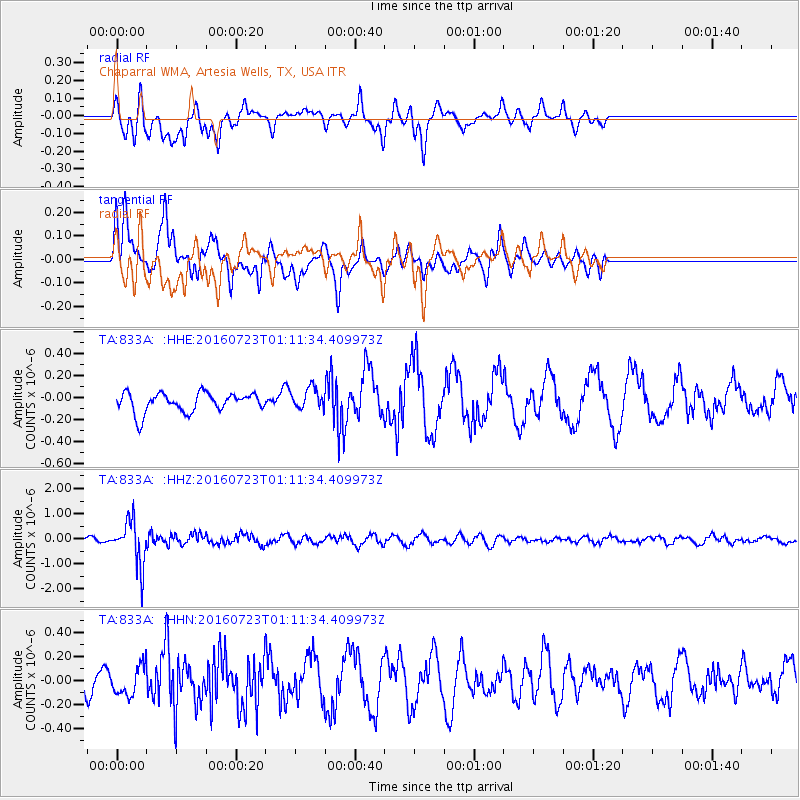
833A Chaparral WMA, Artesia Wells, TX, USA - Earthquake Result Viewer
*The percent match for this event was below the threshold and hence no stack was calculated.
| Earthquake location: |
Northwest Of Kuril Islands |
| Earthquake latitude/longitude: |
47.7/147.0 |
| Earthquake time(UTC): |
2016/07/23 (205) 01:00:21 GMT |
| Earthquake Depth: |
407 km |
| Earthquake Magnitude: |
5.7 MB |
| Earthquake Catalog/Contributor: |
NEIC PDE/NEIC ALERT |
|
| Network: |
TA USArray Transportable Network (new EarthScope stations) |
| Station: |
833A Chaparral WMA, Artesia Wells, TX, USA |
| Lat/Lon: |
28.32 N/99.39 W |
| Elevation: |
171 m |
|
| Distance: |
83.7 deg |
| Az: |
54.331 deg |
| Baz: |
321.511 deg |
| Ray Param: |
$rayparam |
*The percent match for this event was below the threshold and hence was not used in the summary stack. |
|
| Radial Match: |
55.710064 % |
| Radial Bump: |
400 |
| Transverse Match: |
55.532608 % |
| Transverse Bump: |
372 |
| SOD ConfigId: |
11737051 |
| Insert Time: |
2019-04-25 03:15:20.067 +0000 |
| GWidth: |
2.5 |
| Max Bumps: |
400 |
| Tol: |
0.001 |
|
Signal To Noise
| Channel | StoN | STA | LTA |
| TA:833A: :HHZ:20160723T01:11:34.409973Z | 8.155796 | 8.8033596E-7 | 1.0793991E-7 |
| TA:833A: :HHN:20160723T01:11:34.409973Z | 1.1999719 | 1.21441E-7 | 1.0120321E-7 |
| TA:833A: :HHE:20160723T01:11:34.409973Z | 1.1100008 | 9.804545E-8 | 8.832916E-8 |
| Arrivals |
| Ps | |
| PpPs | |
| PsPs/PpSs | |


