You are here: Home > Network List > TA - USArray Transportable Network (new EarthScope stations) Stations List
> Station MDND Maddock, ND, USA > Earthquake Result Viewer
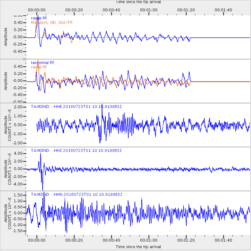
MDND Maddock, ND, USA - Earthquake Result Viewer
*The percent match for this event was below the threshold and hence no stack was calculated.
| Earthquake location: |
Northwest Of Kuril Islands |
| Earthquake latitude/longitude: |
47.7/147.0 |
| Earthquake time(UTC): |
2016/07/23 (205) 01:00:21 GMT |
| Earthquake Depth: |
407 km |
| Earthquake Magnitude: |
5.7 MB |
| Earthquake Catalog/Contributor: |
NEIC PDE/NEIC ALERT |
|
| Network: |
TA USArray Transportable Network (new EarthScope stations) |
| Station: |
MDND Maddock, ND, USA |
| Lat/Lon: |
47.85 N/99.60 W |
| Elevation: |
479 m |
|
| Distance: |
68.6 deg |
| Az: |
41.567 deg |
| Baz: |
318.296 deg |
| Ray Param: |
$rayparam |
*The percent match for this event was below the threshold and hence was not used in the summary stack. |
|
| Radial Match: |
52.606094 % |
| Radial Bump: |
400 |
| Transverse Match: |
72.190216 % |
| Transverse Bump: |
400 |
| SOD ConfigId: |
11737051 |
| Insert Time: |
2019-04-25 03:16:23.578 +0000 |
| GWidth: |
2.5 |
| Max Bumps: |
400 |
| Tol: |
0.001 |
|
Signal To Noise
| Channel | StoN | STA | LTA |
| TA:MDND: :HHZ:20160723T01:10:10.919983Z | 10.911942 | 1.7057793E-6 | 1.5632226E-7 |
| TA:MDND: :HHN:20160723T01:10:10.919983Z | 3.1507971 | 7.3093673E-7 | 2.319847E-7 |
| TA:MDND: :HHE:20160723T01:10:10.919983Z | 1.9716843 | 7.464475E-7 | 3.7858365E-7 |
| Arrivals |
| Ps | |
| PpPs | |
| PsPs/PpSs | |


