You are here: Home > Network List > KN - Kyrgyz Seismic Telemetry Network Stations List
> Station TKM2 - > Earthquake Result Viewer
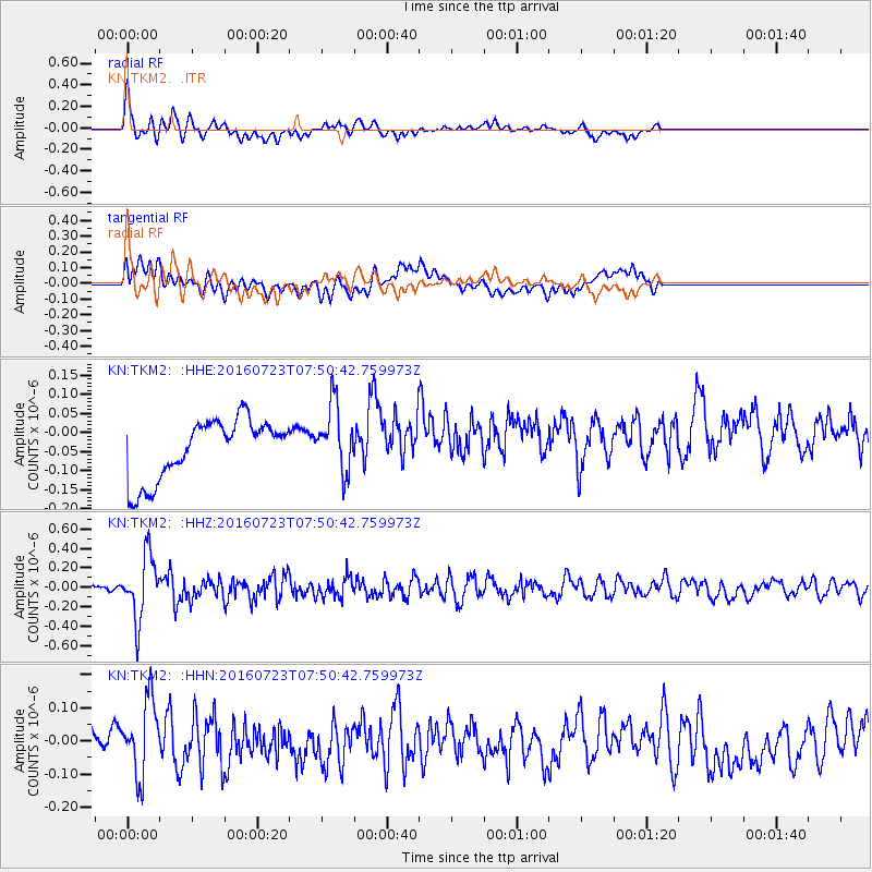
TKM2 - - Earthquake Result Viewer
*The percent match for this event was below the threshold and hence no stack was calculated.
| Earthquake location: |
Southwest Of Sumatra, Indonesia |
| Earthquake latitude/longitude: |
-6.8/101.2 |
| Earthquake time(UTC): |
2016/07/23 (205) 07:41:44 GMT |
| Earthquake Depth: |
10 km |
| Earthquake Magnitude: |
5.5 MWW, 5.5 MWB, 5.5 MWC |
| Earthquake Catalog/Contributor: |
NEIC PDE/NEIC COMCAT |
|
| Network: |
KN Kyrgyz Seismic Telemetry Network |
| Station: |
TKM2 - |
| Lat/Lon: |
42.92 N/75.60 E |
| Elevation: |
2020 m |
|
| Distance: |
54.7 deg |
| Az: |
337.081 deg |
| Baz: |
148.231 deg |
| Ray Param: |
$rayparam |
*The percent match for this event was below the threshold and hence was not used in the summary stack. |
|
| Radial Match: |
77.90235 % |
| Radial Bump: |
388 |
| Transverse Match: |
51.587765 % |
| Transverse Bump: |
400 |
| SOD ConfigId: |
11737051 |
| Insert Time: |
2019-04-25 03:22:58.087 +0000 |
| GWidth: |
2.5 |
| Max Bumps: |
400 |
| Tol: |
0.001 |
|
Signal To Noise
| Channel | StoN | STA | LTA |
| KN:TKM2: :HHZ:20160723T07:50:42.759973Z | 6.80171 | 3.228584E-7 | 4.746724E-8 |
| KN:TKM2: :HHN:20160723T07:50:42.759973Z | 3.4561968 | 1.15614704E-7 | 3.3451425E-8 |
| KN:TKM2: :HHE:20160723T07:50:42.759973Z | 1.1355525 | 8.8731845E-8 | 7.81398E-8 |
| Arrivals |
| Ps | |
| PpPs | |
| PsPs/PpSs | |


