You are here: Home > Network List > IW - Intermountain West Stations List
> Station MOOW Moose Ponds, Wyoming, USA > Earthquake Result Viewer
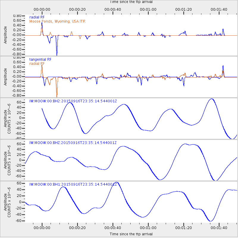
MOOW Moose Ponds, Wyoming, USA - Earthquake Result Viewer
*The percent match for this event was below the threshold and hence no stack was calculated.
| Earthquake location: |
Near Coast Of Central Chile |
| Earthquake latitude/longitude: |
-31.2/-71.8 |
| Earthquake time(UTC): |
2015/09/16 (259) 23:23:26 GMT |
| Earthquake Depth: |
37 km |
| Earthquake Magnitude: |
5.6 MB |
| Earthquake Catalog/Contributor: |
NEIC PDE/NEIC COMCAT |
|
| Network: |
IW Intermountain West |
| Station: |
MOOW Moose Ponds, Wyoming, USA |
| Lat/Lon: |
43.75 N/110.74 W |
| Elevation: |
2128 m |
|
| Distance: |
82.6 deg |
| Az: |
332.643 deg |
| Baz: |
147.074 deg |
| Ray Param: |
$rayparam |
*The percent match for this event was below the threshold and hence was not used in the summary stack. |
|
| Radial Match: |
83.017426 % |
| Radial Bump: |
241 |
| Transverse Match: |
28.12489 % |
| Transverse Bump: |
304 |
| SOD ConfigId: |
1156111 |
| Insert Time: |
2015-10-01 00:20:26.703 +0000 |
| GWidth: |
2.5 |
| Max Bumps: |
400 |
| Tol: |
0.001 |
|
Signal To Noise
| Channel | StoN | STA | LTA |
| IW:MOOW:00:BHZ:20150916T23:35:14.544001Z | 1.0804639 | 2.3598477E-5 | 2.1841059E-5 |
| IW:MOOW:00:BH1:20150916T23:35:14.544001Z | 3.3728838 | 2.7981405E-5 | 8.295988E-6 |
| IW:MOOW:00:BH2:20150916T23:35:14.544001Z | 0.42131534 | 1.5587093E-5 | 3.699626E-5 |
| Arrivals |
| Ps | |
| PpPs | |
| PsPs/PpSs | |


