You are here: Home > Network List > CN - Canadian National Seismograph Network Stations List
> Station INK INUVIK, NT > Earthquake Result Viewer
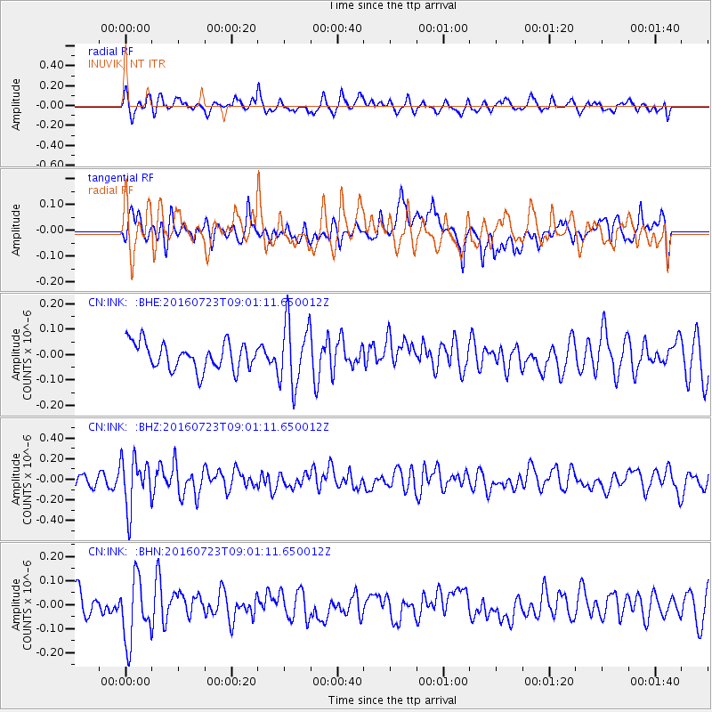
INK INUVIK, NT - Earthquake Result Viewer
*The percent match for this event was below the threshold and hence no stack was calculated.
| Earthquake location: |
Off Coast Of Guerrero, Mexico |
| Earthquake latitude/longitude: |
14.9/-103.5 |
| Earthquake time(UTC): |
2016/07/23 (205) 08:52:02 GMT |
| Earthquake Depth: |
45 km |
| Earthquake Magnitude: |
5.5 MB |
| Earthquake Catalog/Contributor: |
NEIC PDE/NEIC COMCAT |
|
| Network: |
CN Canadian National Seismograph Network |
| Station: |
INK INUVIK, NT |
| Lat/Lon: |
68.31 N/133.53 W |
| Elevation: |
44 m |
|
| Distance: |
56.8 deg |
| Az: |
347.162 deg |
| Baz: |
144.697 deg |
| Ray Param: |
$rayparam |
*The percent match for this event was below the threshold and hence was not used in the summary stack. |
|
| Radial Match: |
61.11254 % |
| Radial Bump: |
400 |
| Transverse Match: |
57.994446 % |
| Transverse Bump: |
400 |
| SOD ConfigId: |
11737051 |
| Insert Time: |
2019-04-25 03:27:04.710 +0000 |
| GWidth: |
2.5 |
| Max Bumps: |
400 |
| Tol: |
0.001 |
|
Signal To Noise
| Channel | StoN | STA | LTA |
| CN:INK: :BHZ:20160723T09:01:11.650012Z | 3.272127 | 2.439763E-7 | 7.4561996E-8 |
| CN:INK: :BHN:20160723T09:01:11.650012Z | 2.7465794 | 1.3342871E-7 | 4.8579956E-8 |
| CN:INK: :BHE:20160723T09:01:11.650012Z | 2.4104562 | 1.2693376E-7 | 5.265964E-8 |
| Arrivals |
| Ps | |
| PpPs | |
| PsPs/PpSs | |


