
CBKS Cedar Bluff, Kansas, USA - Earthquake Result Viewer
| ||||||||||||||||||
| ||||||||||||||||||
| ||||||||||||||||||
|
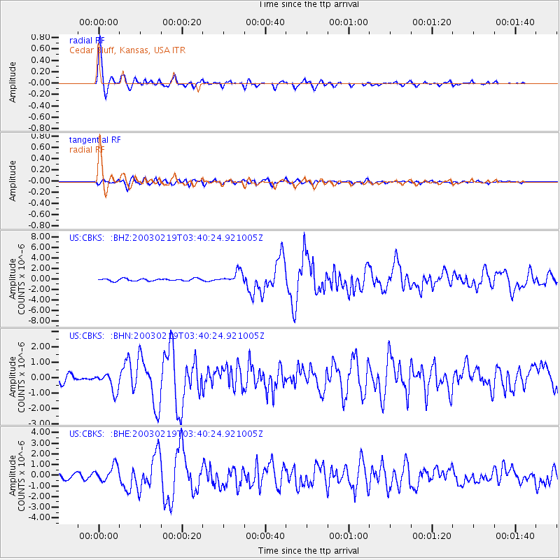
Signal To Noise
| Channel | StoN | STA | LTA |
| US:CBKS: :BHN:20030219T03:40:24.921005Z | 1.9054334 | 6.327308E-7 | 3.320666E-7 |
| US:CBKS: :BHE:20030219T03:40:24.921005Z | 3.7863574 | 7.658011E-7 | 2.0225272E-7 |
| US:CBKS: :BHZ:20030219T03:40:24.921005Z | 5.362336 | 1.1585743E-6 | 2.1605774E-7 |
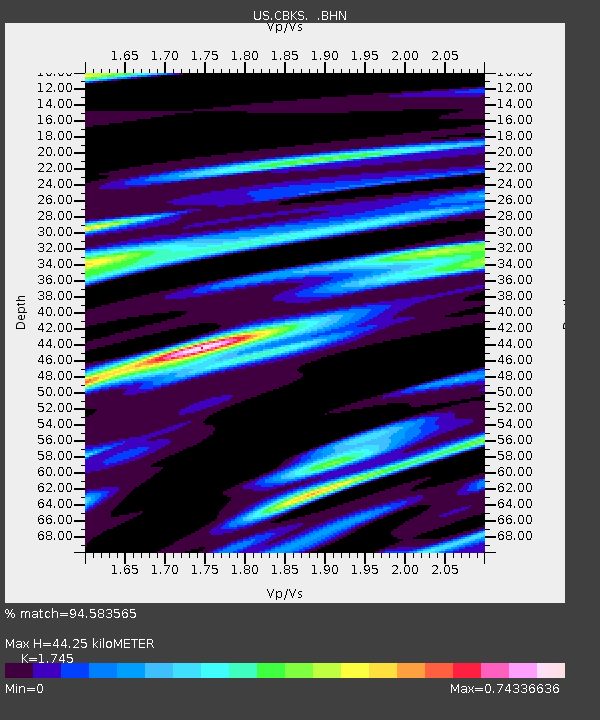
| Arrivals | |
| Ps | 5.4 SECOND |
| PpPs | 18 SECOND |
| PsPs/PpSs | 23 SECOND |

