You are here: Home > Network List > US - United States National Seismic Network Stations List
> Station CBKS Cedar Bluff, Kansas, USA > Earthquake Result Viewer
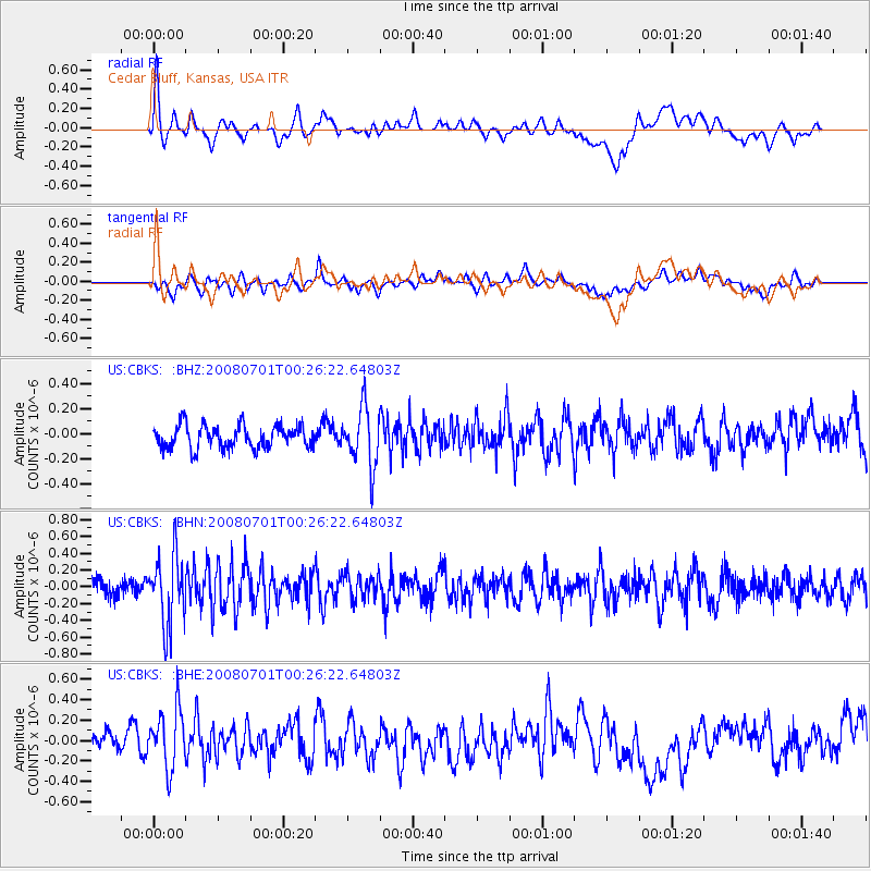
CBKS Cedar Bluff, Kansas, USA - Earthquake Result Viewer
*The percent match for this event was below the threshold and hence no stack was calculated.
| Earthquake location: |
Central Peru |
| Earthquake latitude/longitude: |
-10.4/-75.5 |
| Earthquake time(UTC): |
2008/07/01 (183) 00:17:33 GMT |
| Earthquake Depth: |
33 km |
| Earthquake Magnitude: |
5.5 MW, 5.0 MS, 5.4 MB, 5.3 ML |
| Earthquake Catalog/Contributor: |
WHDF/NEIC |
|
| Network: |
US United States National Seismic Network |
| Station: |
CBKS Cedar Bluff, Kansas, USA |
| Lat/Lon: |
38.81 N/99.74 W |
| Elevation: |
677 m |
|
| Distance: |
53.9 deg |
| Az: |
336.622 deg |
| Baz: |
150.019 deg |
| Ray Param: |
$rayparam |
*The percent match for this event was below the threshold and hence was not used in the summary stack. |
|
| Radial Match: |
48.109913 % |
| Radial Bump: |
400 |
| Transverse Match: |
50.992836 % |
| Transverse Bump: |
400 |
| SOD ConfigId: |
2504 |
| Insert Time: |
2010-03-05 05:34:17.718 +0000 |
| GWidth: |
2.5 |
| Max Bumps: |
400 |
| Tol: |
0.001 |
|
Signal To Noise
| Channel | StoN | STA | LTA |
| US:CBKS: :BHN:20080701T00:26:22.64803Z | 4.17854 | 4.1579253E-7 | 9.950665E-8 |
| US:CBKS: :BHE:20080701T00:26:22.64803Z | 2.3778512 | 2.9495138E-7 | 1.2404114E-7 |
| US:CBKS: :BHZ:20080701T00:26:22.64803Z | 2.5605378 | 2.3330064E-7 | 9.111392E-8 |
| Arrivals |
| Ps | |
| PpPs | |
| PsPs/PpSs | |


