You are here: Home > Network List > TA - USArray Transportable Network (new EarthScope stations) Stations List
> Station R33M Jennings River, BC, CAN > Earthquake Result Viewer
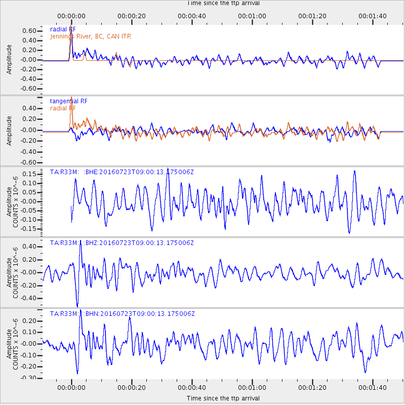
R33M Jennings River, BC, CAN - Earthquake Result Viewer
*The percent match for this event was below the threshold and hence no stack was calculated.
| Earthquake location: |
Off Coast Of Guerrero, Mexico |
| Earthquake latitude/longitude: |
14.9/-103.5 |
| Earthquake time(UTC): |
2016/07/23 (205) 08:52:02 GMT |
| Earthquake Depth: |
45 km |
| Earthquake Magnitude: |
5.5 MB |
| Earthquake Catalog/Contributor: |
NEIC PDE/NEIC COMCAT |
|
| Network: |
TA USArray Transportable Network (new EarthScope stations) |
| Station: |
R33M Jennings River, BC, CAN |
| Lat/Lon: |
59.39 N/130.97 W |
| Elevation: |
1437 m |
|
| Distance: |
48.9 deg |
| Az: |
341.753 deg |
| Baz: |
143.719 deg |
| Ray Param: |
$rayparam |
*The percent match for this event was below the threshold and hence was not used in the summary stack. |
|
| Radial Match: |
65.417015 % |
| Radial Bump: |
400 |
| Transverse Match: |
60.769257 % |
| Transverse Bump: |
400 |
| SOD ConfigId: |
11737051 |
| Insert Time: |
2019-04-25 03:32:33.464 +0000 |
| GWidth: |
2.5 |
| Max Bumps: |
400 |
| Tol: |
0.001 |
|
Signal To Noise
| Channel | StoN | STA | LTA |
| TA:R33M: :BHZ:20160723T09:00:13.175006Z | 3.0745556 | 2.5391472E-7 | 8.258583E-8 |
| TA:R33M: :BHN:20160723T09:00:13.175006Z | 3.060848 | 1.3449643E-7 | 4.3940904E-8 |
| TA:R33M: :BHE:20160723T09:00:13.175006Z | 1.4309361 | 8.397425E-8 | 5.8684837E-8 |
| Arrivals |
| Ps | |
| PpPs | |
| PsPs/PpSs | |


