You are here: Home > Network List > UW - Pacific Northwest Regional Seismic Network Stations List
> Station MRBL Marblemount, WA, USA > Earthquake Result Viewer
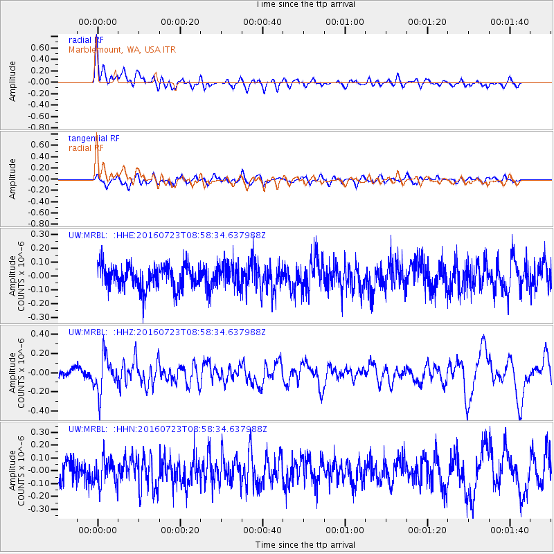
MRBL Marblemount, WA, USA - Earthquake Result Viewer
*The percent match for this event was below the threshold and hence no stack was calculated.
| Earthquake location: |
Off Coast Of Guerrero, Mexico |
| Earthquake latitude/longitude: |
14.9/-103.5 |
| Earthquake time(UTC): |
2016/07/23 (205) 08:52:02 GMT |
| Earthquake Depth: |
45 km |
| Earthquake Magnitude: |
5.5 MB |
| Earthquake Catalog/Contributor: |
NEIC PDE/NEIC COMCAT |
|
| Network: |
UW Pacific Northwest Regional Seismic Network |
| Station: |
MRBL Marblemount, WA, USA |
| Lat/Lon: |
48.52 N/121.48 W |
| Elevation: |
75 m |
|
| Distance: |
36.7 deg |
| Az: |
339.935 deg |
| Baz: |
150.067 deg |
| Ray Param: |
$rayparam |
*The percent match for this event was below the threshold and hence was not used in the summary stack. |
|
| Radial Match: |
74.33413 % |
| Radial Bump: |
400 |
| Transverse Match: |
56.27014 % |
| Transverse Bump: |
400 |
| SOD ConfigId: |
11737051 |
| Insert Time: |
2019-04-25 03:33:02.988 +0000 |
| GWidth: |
2.5 |
| Max Bumps: |
400 |
| Tol: |
0.001 |
|
Signal To Noise
| Channel | StoN | STA | LTA |
| UW:MRBL: :HHZ:20160723T08:58:34.637988Z | 3.0451486 | 1.9375464E-7 | 6.362732E-8 |
| UW:MRBL: :HHN:20160723T08:58:34.637988Z | 1.4979373 | 1.0392345E-7 | 6.9377705E-8 |
| UW:MRBL: :HHE:20160723T08:58:34.637988Z | 1.0694547 | 8.6742695E-8 | 8.110927E-8 |
| Arrivals |
| Ps | |
| PpPs | |
| PsPs/PpSs | |


