You are here: Home > Network List > US - United States National Seismic Network Stations List
> Station CBKS Cedar Bluff, Kansas, USA > Earthquake Result Viewer
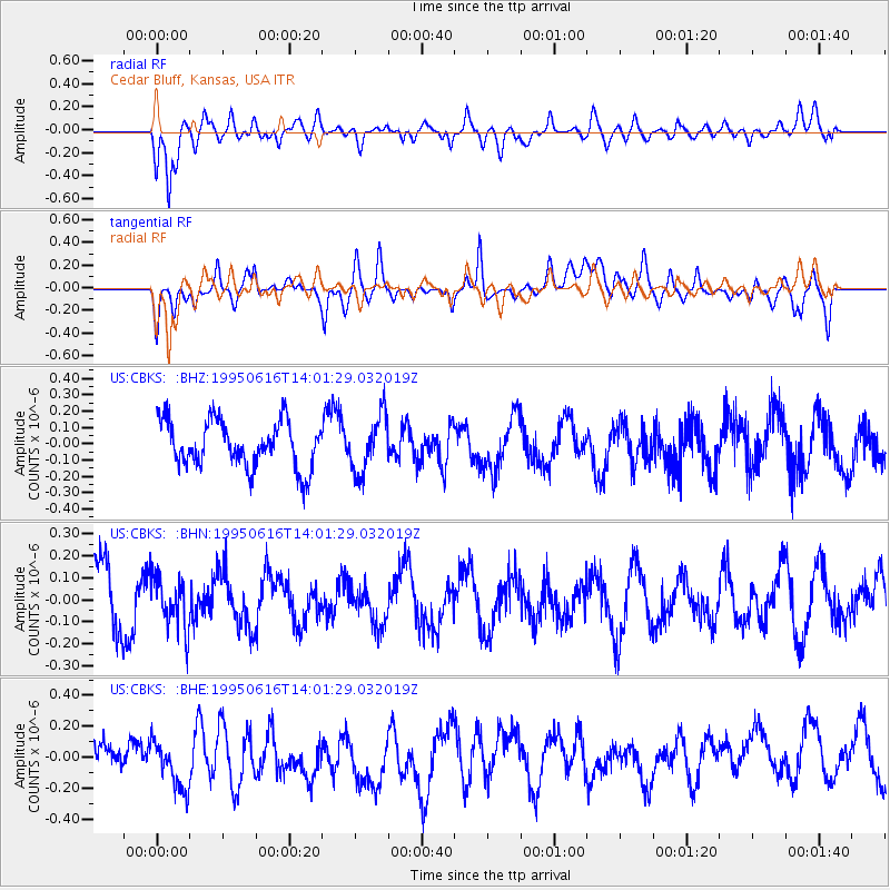
CBKS Cedar Bluff, Kansas, USA - Earthquake Result Viewer
*The percent match for this event was below the threshold and hence no stack was calculated.
| Earthquake location: |
Fiji Islands Region |
| Earthquake latitude/longitude: |
-18.2/-178.0 |
| Earthquake time(UTC): |
1995/06/16 (167) 13:49:49 GMT |
| Earthquake Depth: |
567 km |
| Earthquake Magnitude: |
5.5 MB |
| Earthquake Catalog/Contributor: |
WHDF/NEIC |
|
| Network: |
US United States National Seismic Network |
| Station: |
CBKS Cedar Bluff, Kansas, USA |
| Lat/Lon: |
38.81 N/99.74 W |
| Elevation: |
677 m |
|
| Distance: |
92.5 deg |
| Az: |
49.972 deg |
| Baz: |
248.669 deg |
| Ray Param: |
$rayparam |
*The percent match for this event was below the threshold and hence was not used in the summary stack. |
|
| Radial Match: |
63.914288 % |
| Radial Bump: |
400 |
| Transverse Match: |
47.116673 % |
| Transverse Bump: |
400 |
| SOD ConfigId: |
4480 |
| Insert Time: |
2010-03-05 05:34:38.399 +0000 |
| GWidth: |
2.5 |
| Max Bumps: |
400 |
| Tol: |
0.001 |
|
Signal To Noise
| Channel | StoN | STA | LTA |
| US:CBKS: :BHN:19950616T14:01:29.032019Z | 0.9082958 | 1.15823106E-7 | 1.2751696E-7 |
| US:CBKS: :BHE:19950616T14:01:29.032019Z | 1.4301997 | 1.7425039E-7 | 1.218364E-7 |
| US:CBKS: :BHZ:19950616T14:01:29.032019Z | 1.2081629 | 1.7141372E-7 | 1.4187964E-7 |
| Arrivals |
| Ps | |
| PpPs | |
| PsPs/PpSs | |


