You are here: Home > Network List > US - United States National Seismic Network Stations List
> Station CBKS Cedar Bluff, Kansas, USA > Earthquake Result Viewer
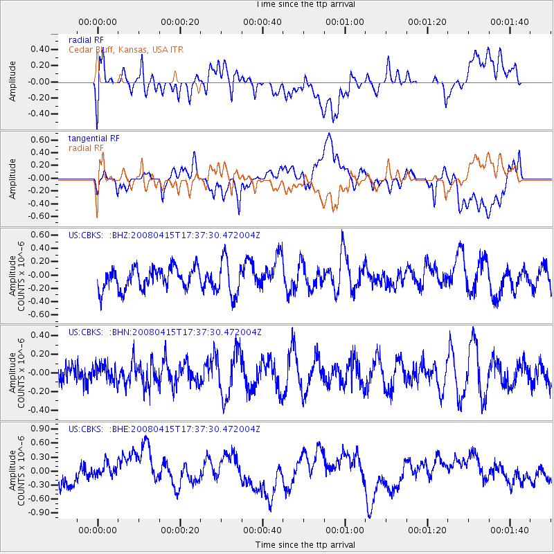
CBKS Cedar Bluff, Kansas, USA - Earthquake Result Viewer
*The percent match for this event was below the threshold and hence no stack was calculated.
| Earthquake location: |
Tonga Islands |
| Earthquake latitude/longitude: |
-18.7/-176.0 |
| Earthquake time(UTC): |
2008/04/15 (106) 17:24:56 GMT |
| Earthquake Depth: |
10 km |
| Earthquake Magnitude: |
5.5 MB, 5.5 MS, 5.7 MW, 5.6 MW |
| Earthquake Catalog/Contributor: |
WHDF/NEIC |
|
| Network: |
US United States National Seismic Network |
| Station: |
CBKS Cedar Bluff, Kansas, USA |
| Lat/Lon: |
38.81 N/99.74 W |
| Elevation: |
677 m |
|
| Distance: |
91.3 deg |
| Az: |
49.371 deg |
| Baz: |
247.049 deg |
| Ray Param: |
$rayparam |
*The percent match for this event was below the threshold and hence was not used in the summary stack. |
|
| Radial Match: |
39.172245 % |
| Radial Bump: |
400 |
| Transverse Match: |
32.307346 % |
| Transverse Bump: |
400 |
| SOD ConfigId: |
2504 |
| Insert Time: |
2010-03-05 05:34:41.734 +0000 |
| GWidth: |
2.5 |
| Max Bumps: |
400 |
| Tol: |
0.001 |
|
Signal To Noise
| Channel | StoN | STA | LTA |
| US:CBKS: :BHN:20080415T17:37:30.472004Z | 0.71322876 | 9.137722E-8 | 1.2811769E-7 |
| US:CBKS: :BHE:20080415T17:37:30.472004Z | 1.0476086 | 2.9537864E-7 | 2.8195515E-7 |
| US:CBKS: :BHZ:20080415T17:37:30.472004Z | 1.7748893 | 2.8321182E-7 | 1.595659E-7 |
| Arrivals |
| Ps | |
| PpPs | |
| PsPs/PpSs | |


