You are here: Home > Network List > US - United States National Seismic Network Stations List
> Station CBKS Cedar Bluff, Kansas, USA > Earthquake Result Viewer
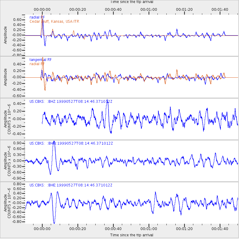
CBKS Cedar Bluff, Kansas, USA - Earthquake Result Viewer
*The percent match for this event was below the threshold and hence no stack was calculated.
| Earthquake location: |
Southeastern Alaska |
| Earthquake latitude/longitude: |
58.7/-137.2 |
| Earthquake time(UTC): |
1999/05/27 (147) 08:08:58 GMT |
| Earthquake Depth: |
10 km |
| Earthquake Magnitude: |
5.5 MB, 5.2 MS, 5.8 MW, 5.4 ML |
| Earthquake Catalog/Contributor: |
WHDF/NEIC |
|
| Network: |
US United States National Seismic Network |
| Station: |
CBKS Cedar Bluff, Kansas, USA |
| Lat/Lon: |
38.81 N/99.74 W |
| Elevation: |
677 m |
|
| Distance: |
31.1 deg |
| Az: |
113.078 deg |
| Baz: |
322.003 deg |
| Ray Param: |
$rayparam |
*The percent match for this event was below the threshold and hence was not used in the summary stack. |
|
| Radial Match: |
60.1723 % |
| Radial Bump: |
400 |
| Transverse Match: |
63.038395 % |
| Transverse Bump: |
400 |
| SOD ConfigId: |
4480 |
| Insert Time: |
2010-03-05 05:34:50.741 +0000 |
| GWidth: |
2.5 |
| Max Bumps: |
400 |
| Tol: |
0.001 |
|
Signal To Noise
| Channel | StoN | STA | LTA |
| US:CBKS: :BHN:19990527T08:14:46.371012Z | 3.252892 | 2.664669E-7 | 8.191692E-8 |
| US:CBKS: :BHE:19990527T08:14:46.371012Z | 1.1153384 | 1.0370272E-7 | 9.29787E-8 |
| US:CBKS: :BHZ:19990527T08:14:46.371012Z | 1.599414 | 1.3666883E-7 | 8.5449315E-8 |
| Arrivals |
| Ps | |
| PpPs | |
| PsPs/PpSs | |


