You are here: Home > Network List > AZ - ANZA Regional Network Stations List
> Station SMER AZ.SMER > Earthquake Result Viewer
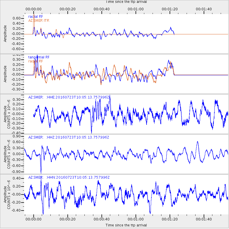
SMER AZ.SMER - Earthquake Result Viewer
*The percent match for this event was below the threshold and hence no stack was calculated.
| Earthquake location: |
Alaska Peninsula |
| Earthquake latitude/longitude: |
58.6/-156.6 |
| Earthquake time(UTC): |
2016/07/23 (205) 09:59:00 GMT |
| Earthquake Depth: |
204 km |
| Earthquake Magnitude: |
5.7 MB, 5.1 MI, 5.4 ML |
| Earthquake Catalog/Contributor: |
NEIC PDE/NEIC COMCAT |
|
| Network: |
AZ ANZA Regional Network |
| Station: |
SMER AZ.SMER |
| Lat/Lon: |
33.46 N/117.17 W |
| Elevation: |
355 m |
|
| Distance: |
36.3 deg |
| Az: |
116.335 deg |
| Baz: |
325.81 deg |
| Ray Param: |
$rayparam |
*The percent match for this event was below the threshold and hence was not used in the summary stack. |
|
| Radial Match: |
53.64064 % |
| Radial Bump: |
400 |
| Transverse Match: |
69.85777 % |
| Transverse Bump: |
400 |
| SOD ConfigId: |
11737051 |
| Insert Time: |
2019-04-25 03:36:28.351 +0000 |
| GWidth: |
2.5 |
| Max Bumps: |
400 |
| Tol: |
0.001 |
|
Signal To Noise
| Channel | StoN | STA | LTA |
| AZ:SMER: :HHZ:20160723T10:05:13.757996Z | 1.9361074 | 2.5979384E-7 | 1.341836E-7 |
| AZ:SMER: :HHN:20160723T10:05:13.757996Z | 1.4313573 | 1.2385033E-7 | 8.65265E-8 |
| AZ:SMER: :HHE:20160723T10:05:13.757996Z | 1.3740329 | 1.4471571E-7 | 1.0532187E-7 |
| Arrivals |
| Ps | |
| PpPs | |
| PsPs/PpSs | |


