You are here: Home > Network List > CI - Caltech Regional Seismic Network Stations List
> Station SWS Sam W. Stewart, Westmorland, CA, USA > Earthquake Result Viewer
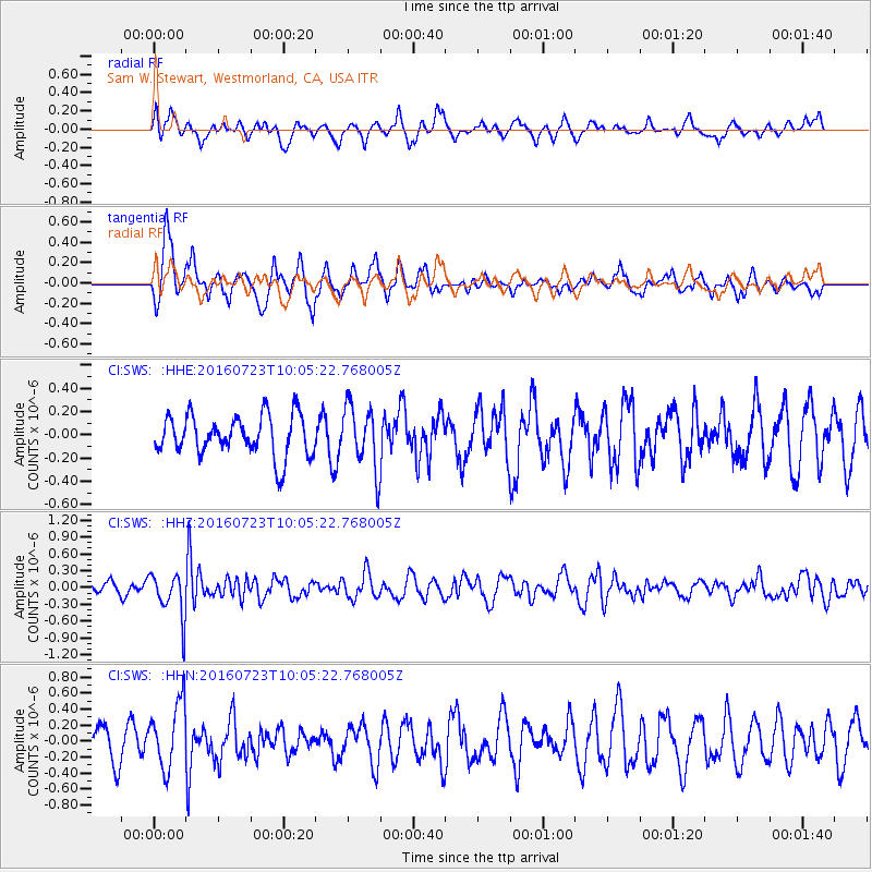
SWS Sam W. Stewart, Westmorland, CA, USA - Earthquake Result Viewer
*The percent match for this event was below the threshold and hence no stack was calculated.
| Earthquake location: |
Alaska Peninsula |
| Earthquake latitude/longitude: |
58.6/-156.6 |
| Earthquake time(UTC): |
2016/07/23 (205) 09:59:00 GMT |
| Earthquake Depth: |
204 km |
| Earthquake Magnitude: |
5.7 MB, 5.1 MI, 5.4 ML |
| Earthquake Catalog/Contributor: |
NEIC PDE/NEIC COMCAT |
|
| Network: |
CI Caltech Regional Seismic Network |
| Station: |
SWS Sam W. Stewart, Westmorland, CA, USA |
| Lat/Lon: |
32.94 N/115.80 W |
| Elevation: |
140 m |
|
| Distance: |
37.4 deg |
| Az: |
115.23 deg |
| Baz: |
325.674 deg |
| Ray Param: |
$rayparam |
*The percent match for this event was below the threshold and hence was not used in the summary stack. |
|
| Radial Match: |
48.9202 % |
| Radial Bump: |
337 |
| Transverse Match: |
68.98731 % |
| Transverse Bump: |
357 |
| SOD ConfigId: |
11737051 |
| Insert Time: |
2019-04-25 03:37:17.405 +0000 |
| GWidth: |
2.5 |
| Max Bumps: |
400 |
| Tol: |
0.001 |
|
Signal To Noise
| Channel | StoN | STA | LTA |
| CI:SWS: :HHZ:20160723T10:05:22.768005Z | 3.510119 | 3.9344403E-7 | 1.12088514E-7 |
| CI:SWS: :HHN:20160723T10:05:22.768005Z | 2.615121 | 4.1060727E-7 | 1.5701272E-7 |
| CI:SWS: :HHE:20160723T10:05:22.768005Z | 1.419666 | 2.4545514E-7 | 1.7289638E-7 |
| Arrivals |
| Ps | |
| PpPs | |
| PsPs/PpSs | |


